

Overview of O-PitSurface 1.8.7
Table of Contents
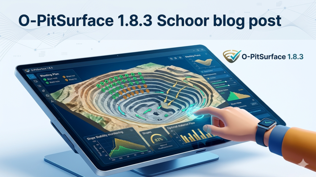
O-PitSurface 1.8.7 is a specialized software solution designed for 3D surface reconstruction, mesh generation, and point cloud processing. Developed by OPTIMUM Mining and Geology, this version focuses on transforming raw survey data into watertight, editable 3D models for engineering, mining, and geospatial analysis.
Unlike general-purpose CAD tools, O-PitSurface 1.8.7 uses proprietary Poisson Surface Reconstruction and Delaunay triangulation algorithms to create accurate surfaces from dense or noisy point clouds. The software is widely adopted for open-pit mining volume calculations, terrain modeling, and reverse engineering.
This article provides a complete technical walkthrough, including installation, key workflows, system requirements, and legal alternatives—all without any references to unauthorized activation methods.
Key Features
O-PitSurface 1.8.7 includes a focused set of tools for surface modeling professionals. Below are the core capabilities:
-
Point Cloud Import & Filtering – Supports LAS, XYZ, TXT, and CSV formats. Includes outlier removal, decimation, and noise reduction filters.
-
Surface Reconstruction Algorithms – Poisson, Screened Poisson, and Greedy Projection Triangulation for different data densities.
-
Mesh Editing Tools – Hole filling, smoothing, decimation, and clipping. Exports watertight STL, OBJ, and PLY files.
-
Volume & Area Calculation – Compute cut/fill volumes between two surfaces or compare a surface to a reference plane.
-
Georeferencing Support – Assign coordinate systems (UTM, local grids) and maintain real-world scaling.
-
Automated Surface Healing – Close non-manifold edges, remove spikes, and fix normals in a single click.
Note for professionals: O-PitSurface 1.8.7 does not include photogrammetry or GIS analysis tools. It is a dedicated surface reconstruction engine.
What’s New in O-PitSurface 1.8.7
Version 1.8.7 is a stability and performance update. Key improvements over previous builds include:
-
Faster Poisson Reconstruction – Up to 30% quicker on point clouds exceeding 10 million points.
-
Memory Optimization – Reduced RAM usage during meshing, allowing larger datasets on standard workstations.
-
Improved LAS File Compatibility – Handles LAS 1.4 format with extended point classes.
-
Batch Processing Queue – Process multiple point cloud files sequentially without user intervention.
-
Enhanced Hole Detection – Better identification of small gaps in thin structures like retaining walls or pipelines.
If you are upgrading from version 1.7.x, note that the project file structure has changed. O-PitSurface 1.8.7 saves surfaces in a new .ops3 format, but it can still export to legacy STL/OBJ.
System Requirements
Before installing, ensure your hardware meets the recommended specifications for smooth operation.
| Component | Minimum | Recommended |
|---|---|---|
| OS | Windows 10 (64-bit) | Windows 11 Pro (64-bit) |
| CPU | Intel Core i5-8400 / AMD Ryzen 5 2600 | Intel Core i7-12700K / AMD Ryzen 7 5800X |
| RAM | 16 GB | 32 GB or more |
| GPU | 2 GB VRAM (OpenGL 4.5) | 8 GB VRAM (NVIDIA RTX 3060 or better) |
| Storage | 10 GB free SSD | 20 GB free NVMe SSD |
| Point Cloud Limit | Up to 5 million points | 20+ million points (with 64 GB RAM) |
O-PitSurface 1.8.7 does not run on macOS or Linux natively. However, it can function inside a Windows virtual machine (VMware or Parallels) with GPU passthrough enabled.
Installation Guide
Follow these steps to install O-PitSurface 1.8.7 legally. You will require a valid license key from OPTIMUM Mining or an authorized reseller.
-
Download the installer – Log into your official OPTIMUM account and download
O-PitSurface_1.8.7_x64_Setup.exe. -
Verify file integrity – Compare the SHA-256 hash with the one provided on the download page.
-
Disable antivirus temporarily (optional) – Some security tools flag legitimate mesh processors. If this occurs, add an exception for the install folder.
-
Run as administrator – Right-click the setup file and select “Run as administrator”.
-
Accept the license agreement – Read the EULA carefully. No reverse engineering or redistribution is allowed.
-
Choose installation directory – Default is
C:\Program Files\OPTIMUM\O-PitSurface. Avoid installing on network drives. -
Select components – You may install the command-line batch processor separately.
-
Complete installation – After installation, launch the software and enter your node-locked or floating license key.
-
Activate offline – If the workstation has no internet, use the offline activation file generated by the license manager.
Important: O-PitSurface 1.8.7 calls home every 30 days to validate subscriptions. Ensure outbound HTTPS access to
licensing.optimum-mining.com.
How to Use O-PitSurface 1.8.7
This section walks through a standard surface reconstruction workflow.
Step 1: Import Point Cloud Data
-
Go to File → Import → Point Cloud.
-
Select your file (LAS, XYZ, or TXT).
-
In the import dialog, assign columns for X, Y, Z, and intensity (if available).
-
Click Preview to check density before full import.
Step 2: Clean and Filter
-
Use Filters → Statistical Outlier Removal (set neighbors to 50, standard deviation multiplier to 2.0).
-
For dense scans, apply Voxel Grid Filter (leaf size = 0.05 meters for fine detail).
Step 3: Reconstruct Surface
-
Navigate to Surface → Poisson Reconstruction.
-
Set Octree Depth (8 for low detail / fast processing, 12 for high detail / slow).
-
Enable Output Watertight Mesh.
-
Click Reconstruct.
Step 4: Edit the Mesh
-
Use Mesh → Fill Holes (max hole size = 500 faces).
-
Apply Mesh → Smooth (Laplacian) with 5 iterations.
-
If the mesh is too dense, use Decimate to reduce face count by 40%.
Step 5: Calculate Volume
-
Select the reconstructed mesh.
-
Choose Analysis → Volume from Plane.
-
Set reference elevation (e.g., lowest point of the pit).
-
The software outputs cut volume, fill volume, and net volume in cubic meters.
Step 6: Export
-
File → Export As → choose STL (for 3D printing), OBJ (for CAD), or PLY (with color).
Best Use Cases
O-PitSurface 1.8.7 excels in professional environments where precision surface modeling is mandatory.
| Industry | Application |
|---|---|
| Mining & Quarrying | Daily stockpile volume tracking, pit wall deformation analysis |
| Civil Engineering | Road surface reconstruction from LiDAR, bridge deck modeling |
| Environmental Science | Erosion monitoring, landslide volume estimation |
| Reverse Engineering | Converting physical parts (via 3D scan) into CAD-ready meshes |
| Cultural Heritage | Creating watertight models of statues or archaeological sites |
For real-time surface reconstruction (e.g., drone-based mapping), consider pairing O-PitSurface with a separate SLAM processing tool.
Advantages and Limitations
Advantages
-
High precision – Maintains millimeter-level accuracy from original point clouds.
-
Low hardware requirements – Runs on older workstations with 16 GB RAM for moderate datasets.
-
Batch processing – Automate reconstruction for hundreds of scans.
-
No cloud dependency – Fully offline after license activation (privacy-friendly).
Limitations
-
Windows-only – No native macOS or Linux version.
-
No photogrammetry – Cannot generate point clouds from images; requires external software (e.g., Metashape, RealityCapture).
-
Steep learning curve – Poisson reconstruction parameters require testing to avoid over-smoothing.
-
License cost – Starts at $1,200/year per user, which may exceed budgets for small firms.
Alternatives to O-PitSurface
If O-PitSurface 1.8.7 does not fit your workflow or budget, consider these legitimate alternatives.
| Software | Best For | Platform | Price Model |
|---|---|---|---|
| CloudCompare (open source) | Point cloud editing & basic meshing | Win/macOS/Linux | Free (GPL) |
| MeshLab (open source) | Advanced mesh cleaning & hole filling | Win/macOS/Linux | Free (GPL) |
| Agisoft Metashape | Photogrammetry + mesh generation | Win/macOS/Linux | 549–549–3,499 one-time |
| Pix4Dsurvey | Survey-grade volume calculations | Win | Subscription (~$2,400/year) |
| Geomagic Wrap | High-end reverse engineering | Win | $15,000+ one-time |
CloudCompare + O-PitSurface is a common professional stack: use CloudCompare for filtering/editing and O-PitSurface for Poisson reconstruction.
Frequently Asked Questions
1. Can O-PitSurface 1.8.7 process drone LiDAR data?
Yes. It directly reads LAS files from DJI Zenmuse L1/L2, Riegl, and Velodyne scanners. Ensure your point cloud is already georeferenced before import.
2. Does O-PitSurface support color information?
Version 1.8.7 retains RGB attributes from PLY and LAS files. Colors are displayed in the viewport and exported to OBJ/PLY formats.
3. How do I obtain a trial license?
OPTIMUM Mining offers a 15-day fully functional trial upon request through their official website. No credit card is required. The trial version restricts export to 5,000 faces.
4. Is there a student or academic discount?
Yes. Accredited universities receive 50% off annual subscriptions. Contact [email protected] with your .edu or institutional email.
5. Can I run O-PitSurface 1.8.7 on a headless server?
No. The software requires an OpenGL 4.5-capable GPU and a graphical session. For server automation, use the separate command-line batch tool (included in the professional edition).
6. What file formats can I export for 3D printing?
STL (binary or ASCII) and OBJ. The mesh is automatically made watertight, so it is ready for slicing software like PrusaSlicer or Cura.
7. Why does my reconstructed surface have spikes?
Spikes usually result from noise in the original point cloud. Apply Statistical Outlier Removal and Radius Outlier Removal before Poisson reconstruction.
8. Does O-PitSurface replace GIS software like QGIS?
No. O-PitSurface only handles 3D surfaces and meshes. For geospatial analysis (slope maps, contours, viewsheds), export your mesh as a GeoTIFF DEM using the “Rasterize Mesh” tool, then import into QGIS.
Final Thoughts
O-PitSurface 1.8.7 remains a reliable, performance-oriented choice for professionals who need accurate surface reconstruction without the bloat of full CAD suites. Its strengths are clear: fast Poisson meshing, efficient memory handling, and a workflow that prioritizes volume calculation and watertight export.
However, it is not an entry-level tool. Beginners should first practice with open-source alternatives like CloudCompare before committing to a license. For mining engineers, geologists, and surveyors who process LiDAR data weekly, the time savings justify the subscription cost.
Always obtain O-PitSurface through official channels. Using unauthorized versions risks malware, legal penalties, and loss of technical support. If your budget is tight, combine free tools (CloudCompare + MeshLab) to achieve 80% of the functionality.
For teams already in the OPTIMUM ecosystem, O-PitSurface 1.8.7 integrates seamlessly with their mine planning suite. Upgrade if you need batch processing or LAS 1.4 support—otherwise, version 1.7.5 remains stable.
Our Paid Service
“We do not sell or provide any software. We only offer professional support services. If any software on your system is not working properly, or you are facing installation errors, crashes, or any other technical issue — just contact us. We will help you fix the problem quickly and remotely via AnyDesk. No software will be provided from our side — only expert troubleshooting and support.”