
Overview of LiDAR360 v9.1
Table of Contents
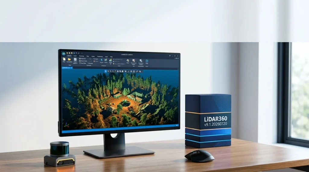
LiDAR360 is an AI-powered LiDAR and photogrammetry data processing software independently developed for industry applications. It functions as a comprehensive point cloud data processing and analysis platform capable of simultaneously loading terabyte-scale point cloud data and processing over 300GB in a single session.
The platform supports 8 data types and 60+ data formats, offering full cross-platform point cloud data compatibility. With over a decade of industry experience, LiDAR360 has been deployed in 137 countries and regions, with global downloads exceeding 150,000.
What Sets LiDAR360 Apart in Point Cloud Processing
Unlike basic point cloud viewers, LiDAR360 provides a unified workflow from raw point cloud data to deliverable products including:
-
Digital Elevation Models (DEM) and Digital Surface Models (DSM)
-
Contour generation and cross-section analysis
-
3D building models (LOD2 specification)
-
Individual tree segmentation and forest survey reports
-
Volume calculations and stockpile measurements
-
Spectral analysis outputs and classification maps
The software’s patented optimized format enables fast loading and rendering of massive datasets without requiring point cloud chunking, significantly improving processing efficiency compared to traditional methods.
Key Features of LiDAR360 v9.1
AI-Powered Point Cloud Classification
The classification module deeply integrates artificial intelligence technology, supporting automatic classification of 30+ feature types. Deep learning-based ground point classification achieves over 94% accuracy, substantially reducing manual editing time.
Key classification capabilities include:
-
One-click ground point, building, and vegetation classification
-
User-trained AI models for custom feature categories
-
Image semantic segmentation for extracting feature outlines from imagery
-
Intelligent classification editing tools for rapid correction
Smart Pattern-Making and 3D Design Integration
LiDAR360 v9.1 introduces enhanced capabilities for smart pattern-making workflows and 3D design integration:
-
Automated building modeling (LOD2) generates level-of-detail 2 building models from airborne point cloud data and vector outlines
-
Gaussian Splatting editing module supports professional-grade editing and optimization of 3DGS models
-
OBJ to 3D Tiles conversion now supports texture compression for optimized web delivery
-
Enhanced terrain calculations including density, weight, void volume, and surface area computations
UAV LiDAR Accuracy Inspection System
The UAV LiDAR precision quality inspection system provides one-click calibration and point cloud accuracy verification, ensuring end-to-end data reliability from acquisition to final output. This integrated workflow covers:
-
Installation error calibration
-
Flight strip adjustment
-
Control point report generation
-
Data quality checks
-
Point cloud denoising and filtering
ModelBuilder and Automated Workflows
ModelBuilder offers over 200 processing modules that can be combined into custom automated workflows. Users can:
-
Create repeatable processing pipelines
-
Run batch operations across multiple datasets
-
Execute distributed computing tasks across local cluster nodes
-
Automate complex multi-step processes through command-line operations
Expanded Data Format Compatibility
LiDAR360 v9.1 expands its already extensive format support with:
-
Full support for BlocksExchange XML format
-
Extended support for tabular, spectral, and model formats
-
Automatic target recognition including X-type targets for control point matching
-
Multi-source data fusion combining point clouds, imagery, raster, vector, and model data
What’s New in LiDAR360 v9.1.20260720
The v9.1 update builds on the major architectural improvements introduced in LiDAR360 V9, which delivered 150+ new features and a fully upgraded user experience. Key enhancements in this release include:
AI and Machine Learning Upgrades
-
SAM3 large model integration enables one-click Gaussian individualization for point cloud objects
-
Optimized reconstruction algorithm delivers a massive increase in reconstructed points compared to V9.0 using the same GPU VRAM
-
New GPU Memory Setting provides users with full command over hardware resource allocation
Mobile Mapping Improvements
For LiDAR360 MLS v9.1, three powerful AI tools are now available:
-
Automatic black hole and blind spot filling for complete data coverage
-
Survey vehicle removal from footage while preserving core scene elements
-
Enhanced mobile mapping data cleanup workflows
Processing Performance Gains
-
Distributed computing for oblique image SFM is now available, increasing image stitching efficiency by 700%+
-
Enhanced GPU memory management for better hardware utilization
-
Improved batch processing capabilities for large-scale projects
System Requirements
LiDAR360 v9.1 requires a reasonably capable workstation for optimal performance. The official specifications are as follows:
Minimum Requirements
| Component | Specification |
|---|---|
| RAM | 32 GB or more |
| CPU | Intel® Core™ i5/i7; dual-core processor |
| Display Adapter | NVIDIA graphics above GTX 970; video memory no less than 4GB |
| Operating System | Windows 7 (64-bit) or later |
Recommended Configuration
For professional workflows involving TB-scale datasets:
| Component | Specification |
|---|---|
| RAM | 32GB and above |
| CPU | Intel Core i7, eight-core/16-thread, 4GHz+ single-core performance |
| Hard Disk | SSD with 100M/s+ transfer speed |
| GPU | NVIDIA RTX 20 series or higher with 8GB+ VRAM |
Important Compatibility Notes
-
OpenGL support: Features like point cloud color rendering, Mesh Editor, and Building Model Display require OpenGL 4.6 and GLSL 4.6 support with at least 4GB video memory
-
Windows Server: LiDAR360 supports Windows Server 2012 and later. Installation and activation must be performed using an administrator account, with software installed in a folder accessible to all users
-
Windows 7 limitation: Full compatibility cannot be guaranteed on certain Windows 7 configurations; Windows 10 or later is recommended
Installation Guide
Step 1: Download the Software
Download the latest version of LiDAR360 Suite from the GreenValley International official website before installation. Ensure you download the correct version for your licensing tier.
Step 2: Run the Setup Wizard
-
Run the LiDAR360 Suite Setup Wizard
-
Click “Next” in the Welcome Interface
-
Click “I Agree” to accept the License Agreement
-
Choose the installation path (or use the default)
-
Click “Install” and wait for completion
-
Click “Finish” when done
Step 3: Configure Graphics Settings
Enable high-performance graphics mode for optimal rendering performance. This is critical for point cloud visualization and 3D modeling operations.
Step 4: License Activation
LiDAR360 offers two licensing approaches:
Option A: License Dongle (Hard Lock)
-
Properly insert the license dongle into a USB port
-
The software will activate automatically
-
Important: Do not format, delete, or copy the license dongle
Option B: License Code (Soft Lock)
-
Run LiDAR360 as administrator
-
Click File > Activate License
-
Fill in your name and company name
-
Select the modules you want to activate
-
Click “Copy” and email the information to [email protected]
-
Receive your authorization key and activate online or offline
Activation Modes
-
Single-Use Licensing: Activated on one computer; supports online and offline activation
-
Concurrent-Use Licensing: Shared across multiple users; requires license server configuration
Trial Information
LiDAR360 offers a 30-day trial period for each version. After the trial expires, the software can still be used as a point cloud visualization tool, but major processing functions will be disabled.
How to Use LiDAR360: Core Workflows
Point Cloud Preprocessing
The preprocessing workflow addresses fundamental data quality issues:
-
Import raw point cloud data from compatible formats (LAS, LAZ, E57, PLY, PCD, etc.)
-
Run strip adjustment to eliminate layering artifacts from calibration and trajectory issues
-
Apply noise filtering to remove outliers and artifacts
-
Perform ground point classification using AI-powered algorithms
-
Generate normalized point clouds for elevation analysis
Terrain Modeling Workflow
For topographic mapping and terrain analysis:
-
Classify ground points from the point cloud
-
Generate DEM (Digital Elevation Model) and DSM (Digital Surface Model)
-
Extract contour lines at specified intervals
-
Create cross-sections for engineering analysis
-
Export results in GeoTIFF, SHP, or DXF formats
Forestry Analysis Workflow
For forest resource assessment:
-
Segment individual trees from ALS or TLS point clouds
-
Extract tree attributes: position, height, DBH, crown diameter, crown volume
-
Calculate stand-level parameters: canopy density, leaf area index
-
Perform regression analysis for biomass and volume estimation
-
Generate 3D tree models for digital forest reconstruction
Building Modeling Workflow
For urban planning and digital twin creation:
-
Classify building points from the point cloud
-
Generate LOD2 building models automatically
-
Edit roof shapes and wall geometry as needed
-
Export OBJ models to BIM software (Revit, SketchUp) for detailed design
Distributed Processing for Large Projects
For enterprise-scale deployments:
-
Configure local cluster nodes or cloud resources
-
Assign processing modules to distributed tasks
-
Monitor progress through the unified dashboard
-
Merge results from parallel processing streams
Best Use Cases
Topographic Surveying and Mapping
LiDAR360 automates the generation of DEM, DSM, contours, and cross-sections, enabling survey engineers to produce accurate topographic deliverables from airborne or mobile LiDAR data. The software’s ability to process TB-scale datasets without chunking makes it suitable for large-area mapping projects.
Forestry Resource Management
Forestry professionals use LiDAR360 for individual tree segmentation, stand analysis, carbon sink assessment, and digital forest management. The software supports both airborne laser scanning (ALS) and terrestrial laser scanning (TLS) data, providing comprehensive forest metrics including biomass and timber volume calculations.
Mining and Stockpile Analysis
Mine survey engineers leverage LiDAR360 for stockpile volume calculations, open-pit slope analysis, and underground roadway modeling. The software provides precise volumetric measurements essential for resource management and safety compliance.
Digital Twin and Smart City Development
Urban planners and BIM engineers use LiDAR360 to generate 3D building models from point cloud data, creating the foundation for digital twin applications and smart city infrastructure management.
Power Line Inspection and Analysis
The platform generates critical engineering parameters for power line inspection, including tower coordinates and heights, conductor catenary curves, conductor spacing, and relative positions of adjacent towers.
Geological Hazard Assessment
Geohazard assessment engineers use LiDAR360 for terrain feature extraction, structural surface analysis, and landslide risk evaluation using high-resolution point cloud data.
Advantages and Limitations
Key Advantages
| Advantage | Description |
|---|---|
| Massive data handling | Patented format supports fast loading of TB-scale datasets without chunking |
| AI-powered automation | Deep learning classification achieves 94%+ accuracy, reducing manual effort |
| Comprehensive toolkit | 700+ functions covering preprocessing through final deliverables |
| Multi-source fusion | Integrates point clouds, imagery, raster, vector, and model data |
| Distributed computing | Scales processing across multiple machines for enterprise workflows |
| Broad format support | 60+ data formats with full cross-platform compatibility |
Limitations to Consider
| Limitation | Consideration |
|---|---|
| Windows-only | No native macOS or Linux support; Windows Server requires admin installation |
| Hardware requirements | TB-scale processing demands 32GB+ RAM and dedicated NVIDIA GPU |
| Learning curve | Professional-grade tools require training for optimal utilization |
| Licensing cost | Commercial licensing may be significant for individual users |
| GPU dependency | Advanced visualization features require OpenGL 4.6 support |
Alternatives to LiDAR360
Professionals evaluating LiDAR360 may also consider these alternatives, each with distinct strengths:
CloudCompare
An open-source point cloud processing tool suitable for smaller datasets and academic research. CloudCompare offers basic classification and measurement tools but lacks the AI-powered automation and TB-scale processing capabilities of LiDAR360.
TerraSolid (TerraScan/TerraMatch)
A well-established commercial suite for airborne LiDAR processing. TerraSolid provides robust strip adjustment and classification tools but requires a more manual workflow compared to LiDAR360’s AI-driven automation.
Leica Cyclone 3DR
A comprehensive terrestrial laser scanning processing solution from Leica Geosystems. Cyclone 3DR excels in high-precision TLS applications but may be less suited for large-scale airborne LiDAR projects.
ArcGIS Pro
Esri’s GIS platform includes LiDAR processing tools for integration with broader geospatial workflows. ArcGIS Pro is ideal for organizations already invested in the Esri ecosystem but offers less specialized point cloud processing depth than LiDAR360.
LP360
A specialized LiDAR processing extension for ArcGIS and standalone use. LP360 provides strong classification and feature extraction tools but may require additional modules for forestry and mining analysis.
Autodesk ReCap Pro
Autodesk’s reality capture software focuses on integrating point cloud data into BIM workflows. ReCap Pro is well-suited for architectural applications but lacks the comprehensive geospatial analysis modules found in LiDAR360.
Frequently Asked Questions
What is LiDAR360 used for?
LiDAR360 is a comprehensive point cloud data processing and analysis platform used for terrain surveying, forestry resource management, mining volume calculations, digital twin creation, power line inspection, and geological hazard assessment. It transforms raw LiDAR and photogrammetry data into structured, decision-ready deliverables.
Can LiDAR360 process large point cloud datasets?
Yes. LiDAR360 is specifically engineered for large-scale data processing. It can load terabyte-scale datasets using its patented optimized format and process over 300GB of point cloud data simultaneously. Distributed computing capabilities allow processing to scale across multiple machines with automatic local cluster node discovery.
What are the system requirements for LiDAR360 v9.1?
The minimum configuration requires 32GB RAM, an Intel Core i5/i7 dual-core processor, and an NVIDIA GPU with at least 4GB video memory running Windows 7 (64-bit) or later. For professional TB-scale workflows, 32GB+ RAM, an eight-core/16-thread i7 processor, and an NVIDIA RTX 20 series GPU with 8GB+ VRAM are recommended.
Does LiDAR360 support macOS or Linux?
No. LiDAR360 is a Windows-native application. It supports Windows 7, 8, 10, and 11 (64-bit) as well as Windows Server 2012 and later. Windows Server installations require administrator account activation and installation in a universally accessible folder.
How do I activate my LiDAR360 license?
LiDAR360 offers two activation methods: a hardware license dongle (USB) and a software license code. For license codes, run the software as administrator, navigate to File > Activate License, fill in your details, select modules, and email the generated information to GreenValley International. You will receive an authorization key that can be activated online or offline.
Is there a free trial for LiDAR360?
Yes. LiDAR360 offers a 30-day trial period for each version. After the trial expires, you can still use the software as a point cloud visualization tool, but major processing functions will be locked until a license is activated.
What file formats does LiDAR360 support?
LiDAR360 supports 60+ data formats across 8 data types. Common point cloud formats include LAS, LAZ, E57, PLY, PCD, and ASCII (.txt, .xyz, .csv). The software also supports raster formats (GeoTIFF), vector formats (SHP, DXF), and model formats (OBJ) for comprehensive multi-source data fusion.
Can LiDAR360 integrate with CAD, GIS, and BIM software?
Yes. LiDAR360 has a complementary relationship with specialized software. It exports DXF files for CAD integration, GeoTIFF/SHP for GIS analysis, and OBJ models for BIM workflows in Revit or SketchUp. It also works alongside photogrammetry tools like DJI Terra and Pix4D for complete project pipelines.
How does LiDAR360 compare to TerraSolid and CloudCompare?
LiDAR360 offers AI-powered automation and TB-scale distributed processing that distinguishes it from TerraSolid’s more manual workflow and CloudCompare’s open-source approach. While TerraSolid remains a strong choice for traditional airborne LiDAR processing and CloudCompare is suitable for smaller academic projects, LiDAR360 combines automated classification, comprehensive industry modules, and enterprise-scale data handling in a single platform.
What industries does LiDAR360 serve?
LiDAR360 serves professionals in terrain/GIS, forestry (ALS+TLS), mining, building/digital twin, spectral analysis, geology, photogrammetry, and scientific/academic research. Each industry has dedicated modules with specialized tools for domain-specific workflows.
Final Thoughts
LiDAR360 v9.1.20260720 represents a mature, enterprise-grade solution for professionals who need to transform raw point cloud data into actionable geospatial intelligence. The software’s combination of AI-powered classification, TB-scale processing capability, smart pattern-making tools, and comprehensive 3D design integration addresses the full lifecycle of LiDAR data processing.
For survey engineers, forestry professionals, mining specialists, and digital twin developers, LiDAR360 offers a depth of functionality that general-purpose GIS tools cannot match. The v9.1 update builds on an already robust platform with meaningful improvements in GPU optimization, AI model integration, and distributed processing efficiency.
Key considerations before adopting LiDAR360:
-
Hardware investment: Budget for a workstation with 32GB+ RAM and a dedicated NVIDIA GPU to unlock full processing capabilities
-
Training investment: The 700+ tools represent significant capability, but users should expect a learning curve for advanced workflows
-
Licensing model: Evaluate whether single-use or concurrent-use licensing better fits your team’s deployment scenario
-
Ecosystem fit: LiDAR360 works best as part of a broader workflow that may include CAD, GIS, and BIM tools for downstream design and analysis
For organizations processing large-scale LiDAR datasets across surveying, forestry, mining, or smart city applications, LiDAR360 v9.1 delivers a compelling combination of automation, precision, and scalability that positions it among the leading professional point cloud processing platforms available in 2026.
Our Paid Service
“We do not sell or provide any software. We only offer professional support services. If any software on your system is not working properly, or you are facing installation errors, crashes, or any other technical issue — just contact us. We will help you fix the problem quickly and remotely via AnyDesk. No software will be provided from our side — only expert troubleshooting and support.”