
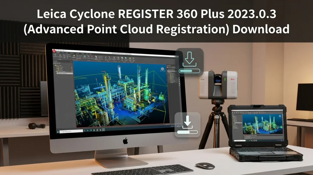

Overview of Leica Cyclone REGISTER 360 Plus
Table of Contents
In the fast-paced world of 3D laser scanning, efficiency and precision are paramount. Leica Cyclone REGISTER 360 Plus is engineered to meet these demands. It is a complete software solution for registering and visualizing point cloud data from Leica Geosystems scanners.
Unlike traditional registration software that can be complex and slow, REGISTER 360 Plus introduces a “smart” workflow. Its user-friendly interface guides professionals through the registration process, from data import to the generation of a final, registered model. This focus on usability does not compromise its professional-grade capabilities.
The “Plus” version of the software builds upon the robust foundation of REGISTER 360 by adding advanced features such as enhanced automated targetless registration and cloud-to-cloud (C2C) alignment. These capabilities are crucial for large-scale projects that generate massive datasets, allowing for rapid processing without sacrificing accuracy. It enables professionals to manage, clean, and register point clouds in a unified environment, creating a single, coherent digital twin of a physical site. The software’s ability to integrate seamlessly with other Leica Geosystems products, like the BLK360 and RTC360, makes it an indispensable asset for a modern reality capture workflow.
Key Features of Cyclone REGISTER 360 Plus
The software is packed with features designed to streamline the registration process and deliver high-quality results.
-
Smart Workflow: The intuitive “Smart Workflow” guides users step-by-step, making the software accessible to beginners while remaining powerful for experts. This significantly reduces training time and the potential for user error.
-
Advanced Registration Algorithms: It uses sophisticated algorithms for both target-based and targetless registration to align scans. The advanced cloud-to-cloud (C2C) registration is particularly effective for complex environments where placing targets is difficult.
-
Visual Alignment & Import: The software allows for visual alignment of scans, giving users manual control to fix registration errors. Its ability to import and process data from a wide range of Leica scanners makes data intake and pre-processing quicker than ever.
-
Comprehensive Quality Control: Built-in quality control (QC) features, such as the visual alignment and bundle adjustment, allow users to analyze the registration’s accuracy in real-time, ensuring the highest level of precision for the final project.
-
Project Collaboration: The software supports cloud-based collaboration, allowing team members to work on the same project simultaneously. This is a key feature for large teams operating across different locations.
-
Point Cloud Visualization: It offers a rich set of tools for visualizing point clouds, from different colorization schemes to the creation of highly accurate 3D models and animations for client presentations.
What’s New in the Latest Version (2023.0.3)
The 2023.0.3 update focuses on refining the user experience and boosting performance for large-scale data processing. It introduces several key improvements.
Automation and Efficiency
A major enhancement is the increased level of automation in the registration process. The software’s algorithms for point cloud alignment have been improved to better handle data with varying densities and to identify tie points more effectively. This translates directly to less manual work and faster project completion.
Performance Optimizations
Performance has been a significant focus. The 2023.0.3 version includes various optimizations under the hood that speed up data loading and processing times, particularly with the massive datasets typical of modern 3D scanning projects. This ensures that even the most complex projects are handled smoothly.
Improved User Interface
The user interface has been slightly streamlined for better clarity and workflow. Menus have been reorganized for more intuitive access to advanced features like the bundle adjustment, while tooltips and in-software documentation have been expanded to make the software more self-explanatory.
System Requirements
To run Leica Cyclone REGISTER 360 Plus 2023.0.3 effectively, your system should meet the following requirements.
-
Operating System: Windows 10 (64-bit) or Windows 11 (64-bit)
-
Processor: Intel Core i7 or higher (Xeon recommended for large projects)
-
RAM: 16 GB minimum, 32 GB or more recommended for large projects
-
Graphics Card: A high-performance NVIDIA graphics card with at least 4 GB of VRAM, compatible with DirectX 11 or higher
-
Storage: SSD for the OS and software installation, with a separate high-capacity HDD/SSD for project data and raw scans
-
Network: A high-speed internet connection is required for license validation and cloud features
Installation Guide
Installing Cyclone REGISTER 360 Plus is straightforward. Follow these steps to set up the software.
-
Obtain the Installer: Download the official installer from the Leica Geosystems “MyWorld” portal.
-
Run the Installer: Double-click the downloaded
.exefile and accept the User Account Control (UAC) prompt. -
License Agreement: Read and accept the End-User License Agreement (EULA).
-
Choose Installation Options: Select the installation directory and components.
-
License Server: For network licenses, enter the server information.
-
Complete the Installation: Click “Install” and wait for the process to finish.
-
Restart Computer: Restart your system to finalize all installations.
How to Use the Software
The power of Leica Cyclone REGISTER 360 Plus is in its structured workflow. Here is a basic guide to registering your data.
Step 1: Create a New Project
Launch the software and create a new project. Name it and define its storage location.
Step 2: Import Scan Data
Use the import function to bring in your scan data. The software supports structured and unstructured data from various Leica scanners.
Step 3: Automatic Registration
This is where the software’s power shines. The system will automatically find tie points between scans. This is the smart workflow in action, reducing a process that once took hours to minutes.
Step 4: Manual Control & Quality Control
You can manually adjust alignments for complex areas. Use the quality control tools to verify the project’s accuracy and make corrections.
Step 5: Finalize and Export
Once satisfied with the registration, finalize it. You can then export the registered point cloud in various formats.
Best Use Cases for Cyclone REGISTER 360 Plus
This software is invaluable across numerous industries.
-
Large-Scale Surveying: For land and topographic surveys, REGISTER 360 Plus quickly generates accurate models from thousands of scans.
-
BIM and Construction: It is a critical tool for Building Information Modeling (BIM), creating as-built models for construction verification, progress monitoring, and clash detection.
-
Industrial Facility Management: It is used to create digital twins of factories, power plants, and processing facilities for planning and safety analysis.
-
Forensic Investigation: The software’s ability to create highly accurate 3D reconstructions is used in accident and crime scene investigations.
Advantages and Limitations
Advantages:
-
Speed & Efficiency: The smart workflow and powerful algorithms dramatically speed up registration.
-
Ease of Use: The interface is more intuitive than many competitors, lowering the learning curve.
-
Integration: Offers unmatched integration within the Leica Geosystems ecosystem.
-
Powerful Algorithms: Advanced registration algorithms handle complex datasets well.
-
Quality Control: Robust QC features ensure high accuracy.
-
Scalability: Manages projects of any size, from a single room to an entire city block.
Limitations:
-
Ecosystem Lock-in: Optimized for Leica Geosystems hardware, limiting its use with other scanners.
-
Cost: The software is a premium product with a high price point for perpetual licenses.
-
Resource Intensive: Requires a powerful workstation to operate efficiently.
-
Learning Curve for Advanced Features: While easy to start, mastering all advanced settings requires expertise.
Alternatives to Leica Cyclone REGISTER 360 Plus
While a leading tool, there are other software options in the 3D point cloud registration market.
-
Trimble RealWorks: A comprehensive point cloud processing solution that is hardware-agnostic.
-
FARO Scene: Designed specifically for processing data from FARO scanners.
-
Riegl RiSCAN PRO: A powerful tool for processing data from RIEGL scanners.
-
CloudCompare: An open-source, free alternative for point cloud visualization and basic registration.
Frequently Asked Questions
What is point cloud registration?
Point cloud registration is the process of aligning multiple 3D scans, taken from different positions, into a single, coherent 3D model.
What is the difference between Cyclone REGISTER 360 and REGISTER 360 Plus?
The “Plus” version offers enhanced automated registration features, such as more advanced targetless registration algorithms.
Does the software support targetless registration?
Yes, the software’s powerful algorithm can automatically register scans without needing physical targets.
What are the system requirements for Cyclone REGISTER 360 Plus 2023.0.3?
The software requires a 64-bit version of Windows 10 or 11, an Intel Core i7 or Xeon processor, at least 16 GB of RAM (32 GB+ recommended), and a high-performance NVIDIA graphics card.
Can I register scans from different types of Leica scanners?
Yes, the software can import and seamlessly register data from a wide range of Leica scanners, including the BLK360, RTC360, P-Series, and ScanStation models.
What is a “smart workflow”?
The “smart workflow” is an intuitive, step-by-step process that simplifies the registration, making it accessible to professionals of all skill levels.
Final Thoughts
Leica Cyclone REGISTER 360 Plus 2023.0.3 is more than just an update; it is a statement of intent from Leica Geosystems. It represents the future of reality capture software, where power meets usability. The software’s enhanced automation and performance optimizations cater to both the expert and the newcomer, making high-accuracy point cloud registration more accessible than ever. Whether you are surveying a building, a bridge, or an entire landscape, REGISTER 360 Plus provides the tools you need to create accurate, reliable, and valuable digital twins with unprecedented speed and efficiency.