
Overview of EIVA NaviEdit 9.1.0
Table of Contents
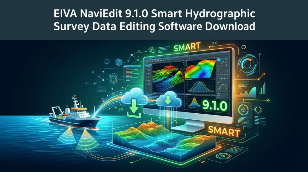
EIVA NaviEdit 9.1.0 is not just a data viewer; it is a comprehensive multi-sensor data editing software. Its primary function is to provide hydrographers, geophysicists, and marine surveyors with the tools to ensure the integrity and quality of their raw survey data before it is exported for final processing and charting.
The software is renowned for its speed and ability to handle both real-time and post-processed data from a vast range of marine survey systems. Its intuitive yet powerful interface allows professionals to identify and correct anomalies, making it an indispensable tool for projects in the maritime, offshore, and research sectors. From high-resolution seabed mapping to critical infrastructure inspection, the software ensures that the data foundation is solid and reliable.
NaviEdit’s strength lies in its seamless integration with the wider EIVA software ecosystem, particularly its acquisition software, EIVA NaviSuite. This synergy creates a smooth, end-to-end workflow from data collection to final editing, significantly reducing the risk of errors and increasing overall productivity.
Key Features of EIVA NaviEdit 9.1.0
EIVA NaviEdit 9.1.0 is packed with specialized features that make it a leader in its niche. Here is a breakdown of its core capabilities:
-
Advanced 3D Visualization: The software provides real-time 3D visualization of data points, allowing users to inspect bathymetry from any angle. This is crucial for identifying complex features, outliers, and potential data gaps that might be missed in a 2D view. You can rotate, zoom, and pan through millions of soundings with minimal latency.
-
Multi-Sensor Data Integration: A key strength is its ability to import, synchronize, and display data from multiple sensors simultaneously. It can handle multibeam bathymetry, sidescan sonar mosaics, sub-bottom profiles, and navigation data (from GPS, INS, and USBL systems) in a single workspace. This provides a holistic understanding of the survey area.
-
Powerful and Flexible Data Editing: The software offers a wide range of editing tools, including:
-
Geometric editing: For correcting heave, pitch, roll, and navigation errors.
-
Statistical editing: Using robust algorithms like CUBE (Combined Uncertainty and Bathymetry Estimator) for automatic data cleaning.
-
Spatial editing: Using swipe, brush, and polygon selection tools to manually identify and reject bad soundings.
-
-
Real-Time Data Editing: One of the most powerful features is the ability to edit data in real-time during acquisition. This allows surveyors to correct issues immediately, ensuring data quality is maintained throughout the project.
-
Extensive File Format Support: EIVA NaviEdit 9.1.0 supports a wide variety of industry-standard data formats, making it compatible with almost any survey system. This includes direct streaming from and data import from formats like XTF, ALL, GSF, and NMEA.
What’s New in EIVA NaviEdit 9.1.0
The 9.1.0 version of NaviEdit represents a significant step forward in hydrographic data processing. While it builds on the stability of previous versions, it introduces key enhancements focused on performance and user workflow:
-
Enhanced Performance and Speed: Version 9.1.0 has been optimized to handle even larger datasets with greater speed. This is achieved through improved memory management and multi-core processing, allowing users to work with high-density multibeam data without noticeable slowdowns.
-
Improved Data Visualization Tools: The 3D rendering engine has been refined to provide a more detailed and responsive viewing experience. This includes better color mapping for depth representation and more efficient rendering of dense point clouds, allowing for faster and more precise manual editing.
-
Streamlined User Interface: The user interface has been refined for improved usability. Menus and toolbars are more intuitive, allowing both new and experienced users to access powerful editing functions with fewer clicks. This reduces the learning curve and speeds up the overall workflow.
-
Enhanced CUBE Processing: The implementation of the CUBE algorithm has been updated for greater automation and accuracy. The new version provides more nuanced parameters for automatic data cleaning, helping surveyors to produce cleaner, more reliable data with less manual intervention.
-
Expanded Hardware and Sensor Compatibility: Version 9.1.0 extends support to newer sensor models, ensuring that users can integrate the latest survey technology directly into their workflow. This includes updates for specific INS and USBL systems.
System Requirements for EIVA NaviEdit 9.1.0
To run EIVA NaviEdit 9.1.0 effectively, your system should meet or exceed the following requirements:
Minimum Requirements:
-
Operating System: Windows 10 (64-bit)
-
Processor: Quad-core Intel or AMD processor (e.g., Intel Core i5)
-
RAM: 16 GB
-
Graphics: Dedicated graphics card with 2 GB+ RAM (e.g., NVIDIA Quadro P1000) supporting OpenGL 4.5
-
Storage: 1 GB free disk space for installation, plus ample space for data processing (SSD recommended)
-
Network: Gigabit Ethernet for license management.
Recommended Requirements for Optimal Performance:
-
Operating System: Windows 11 (64-bit)
-
Processor: High-performance hexa-core or octa-core processor (e.g., Intel Core i7/i9 or AMD Ryzen 7/9)
-
RAM: 32 GB or higher
-
Graphics: High-performance dedicated graphics card with 8 GB+ RAM (e.g., NVIDIA Quadro RTX A4000 or higher)
-
Storage: 1 TB NVMe SSD for fast data loading and processing.
-
Network: A stable internet connection for licensing and updates.
Installation Guide for EIVA NaviEdit 9.1.0
Installing the EIVA NaviEdit software involves a straightforward process to ensure your system is correctly configured.
-
Obtain the Software: First, download the installer from the official EIVA distribution portal or contact EIVA support to get the latest version. Ensure you have a valid license.
-
System Preparation: Before installation, close all other applications. It is also recommended to temporarily disable your antivirus software to prevent it from interfering with the installation process, though this is typically not necessary.
-
Run the Installer: Navigate to the downloaded installer file (.exe) and right-click to “Run as administrator.” This provides the necessary permissions to install system files.
-
Follow the Setup Wizard:
-
Accept License Agreement: Read and accept the End-User License Agreement (EULA).
-
Select Installation Directory: Choose the destination folder for the software files. The default location (C:\Program Files\EIVA\NaviEdit) is usually recommended.
-
Select Components: Choose the components you wish to install. Typically, a full installation is recommended for all features.
-
License Setup: You will be prompted to configure your license. This involves either connecting to a network license server or installing a local license file provided by EIVA.
-
-
Complete the Installation: Click “Install” to begin the file copying process. Once complete, you can launch the software from the desktop shortcut or Windows Start Menu.
How to Use EIVA NaviEdit 9.1.0
Getting started with EIVA NaviEdit 9.1.0 is designed to be as efficient as possible, though mastering its full capability requires practice.
Step 1: Starting a New Project
Open the software and create a new project. Set the directory and project name. The project will organize all your files, configurations, and processed data in one place.
Step 2: Importing or Connecting Data
You can either import data from a supported file (e.g., .xtf, .all, .gsf) or, if you have a compatible system, connect directly to a live data stream for real-time data editing. You can add multiple files to a single project to work on a larger survey area.
Step 3: Navigating the 3D View
Use the mouse (pan, rotate, zoom) to navigate the 3D seabed model. The software uses a multi-view setup, allowing you to see the data from plan, profile, and 3D perspectives simultaneously. This makes identifying anomalies much easier.
Step 4: Identifying and Editing Anomalies
Use the editing tools to clean your dataset. The CUBE algorithm can be run to automatically flag and clean data points that do not fit the statistical model. For manual editing:
-
Use the Swipe Editor to selectively accept or reject soundings by painting over them.
-
Use polygon selections to remove groups of unwanted points (e.g., noise from ship’s propeller wash).
-
Use profile editing to view a single cross-section of the seabed and adjust for tide or navigation errors.
Step 5: Validating and Saving
Once editing is complete, run a validation check to ensure no data integrity issues remain. Finally, export your cleaned, validated data in a format ready for final processing, chart creation, or delivery to the client.
Best Use Cases for EIVA NaviEdit 9.1.0
EIVA NaviEdit 9.1.0 is utilized across a broad range of marine and hydrographic applications.
-
High-Resolution Seabed Mapping: For detailed surveys of harbors, shipping channels, and offshore areas, ensuring accurate and obstruction-free navigation.
-
Offshore Wind Farm Development: Editing data from surveys of wind farm sites is critical for turbine foundation design and cable route planning. The software’s ability to handle complex terrain and multi-sensor data is essential here.
-
Pipeline and Cable Route Inspections: Analyzing precise data to ensure pipelines and subsea cables are laid on a stable, obstruction-free seabed.
-
Marine Archaeology: Post-processing of data from surveys that aim to discover and document submerged historical sites, requiring high accuracy and meticulous editing.
-
Scientific Research: Researchers use it for a wide range of studies, from geomorphology to marine biology, where accurate seabed classification is vital.
-
Dredging and Coastal Engineering: Accurately measuring and monitoring the volume of material being dredged to ensure project compliance and efficiency.
Advantages and Limitations of EIVA NaviEdit 9.1.0
Advantages
-
Industry Standard: Widely accepted by charting authorities and offshore companies, ensuring seamless collaboration.
-
Powerful Feature Set: Offers the most comprehensive set of tools for editing multi-sensor hydrographic data.
-
Real-Time Editing Capability: A significant advantage for maximizing at-sea time.
-
Excellent Integration: Works perfectly within the EIVA ecosystem and supports numerous third-party formats.
-
Reliable and Stable: Built on a robust and proven codebase, trusted for mission-critical projects.
Limitations
-
Cost: Licensing this software represents a significant investment, making it more suitable for large organizations and professionals rather than individual hobbyists.
-
Learning Curve: With its advanced features comes a relatively steep learning curve. Users require formal training to use all functions efficiently.
-
Hardware Requirements: Demands high-performance hardware to handle very large datasets smoothly.
Alternatives to EIVA NaviEdit 9.1.0
While EIVA NaviEdit is a market leader, several other software packages offer similar capabilities for the hydrographic community.
-
Teledyne Caris HIPS & SIPS: A direct and powerful competitor. It is a highly advanced suite for processing, editing, and analyzing bathymetric data, known for its robust data management and visualization capabilities.
-
QPS Qimera: Another prominent hydrographic software solution. Qimera is praised for its fast and intuitive workflow, powerful 3D editing tools, and comprehensive support for the CUBE algorithm.
-
NovAtel Waypoint Inertial Explorer: While primarily a GNSS/INS post-processing software, it includes significant capabilities for georeferencing and cleaning of raw survey data, acting as an alternative solution in some workflows.
-
Oceanic Imaging Consultants (OIC) Fledermaus: A powerful 3D visualization and analysis software. While it is more focused on interactive 3D visualization, its “Scope” module offers robust data editing capabilities.
Frequently Asked Questions about EIVA NaviEdit
1. What is EIVA NaviEdit 9.1.0 used for?
EIVA NaviEdit 9.1.0 is a professional software used primarily for editing and validating hydrographic survey data from sensors like multibeam echosounders, sidescan sonars, and sub-bottom profilers. It ensures data accuracy for nautical charting and marine construction projects.
2. Can I edit data in real-time with NaviEdit?
Yes, one of the software’s major advantages is the ability to perform real-time data editing. It can connect directly to survey data streams, allowing you to clean and validate data during acquisition and re-survey any problematic areas immediately.
3. Does EIVA NaviEdit support data from other software?
Absolutely. It supports a wide range of industry-standard file formats, including XTF, GSF, ALL, and various NMEA strings, making it highly compatible with data from any major hydrographic acquisition system.
4. What is the main difference between EIVA NaviEdit and NaviModel?
NaviEdit is primarily a data editing and validation software. EIVA NaviModel, on the other hand, is its sister software used for advanced 3D visualization, modeling, and object detection. They are often used in tandem for a complete workflow.
5. What is the CUBE algorithm in NaviEdit?
CUBE (Combined Uncertainty and Bathymetry Estimator) is a powerful statistical algorithm integrated into NaviEdit. It automatically assesses the uncertainty of depth measurements and filters out soundings that are statistically likely to be erroneous, significantly speeding up the editing process.
6. What are the hardware requirements for running EIVA NaviEdit?
The software requires a robust system, preferably a Windows 10/11 64-bit PC with a fast multi-core processor, at least 16-32 GB of RAM, and a high-performance dedicated graphics card for smooth visualization of large datasets.
Final Thoughts on EIVA NaviEdit 9.1.0
EIVA NaviEdit 9.1.0 firmly establishes itself as an essential and powerful tool for marine survey professionals. Its unmatched ability to process, visualize, and edit complex multi-sensor data in both real-time and post-processing environments makes it a cornerstone of the modern hydrographic workflow.
While its sophistication comes with a significant price tag and a learning curve, the return on investment in terms of data quality, operational efficiency, and client confidence is substantial. For any serious hydrographic surveyor, oceanographer, or offshore project manager, NaviEdit is a critical asset that helps ensure the integrity, safety, and success of marine projects. By understanding its capabilities, you can make an informed decision about integrating this powerful software into your data processing pipeline.
Our Paid Service
“We do not sell or provide any software. We only offer professional support services. If any software on your system is not working properly, or you are facing installation errors, crashes, or any other technical issue — just contact us. We will help you fix the problem quickly and remotely via AnyDesk. No software will be provided from our side — only expert troubleshooting and support.”