Overview of the Software
Table of Contents
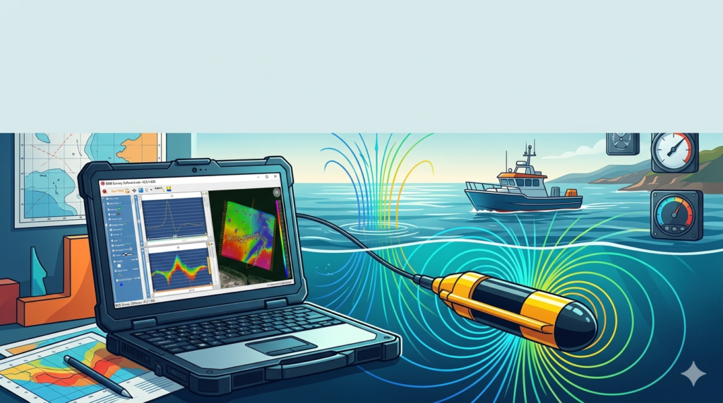
Marine Magnetics BOB Survey Software 8.5.1.668 is a professional-grade geophysical data acquisition and processing platform designed specifically for marine magnetometer surveys. Released in 2026, this version continues to support the industry-standard BOB (Boat-towed Overhauser Bundle) system, enabling geophysicists, hydrographers, and survey contractors to collect high-sensitivity total-field magnetic data for subsea UXO detection, pipeline route surveys, and archaeological mapping.
Unlike generic data loggers, this software provides real-time magnetic anomaly visualization, diurnal correction integration, and seamless export to GIS platforms. As a legally licensed tool, it requires a valid hardware key or subscription from Marine Magnetics Corp—no third-party activators or unauthorized modifications are supported.
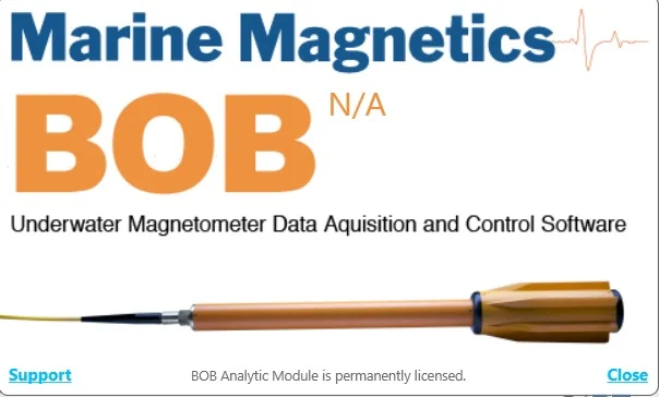
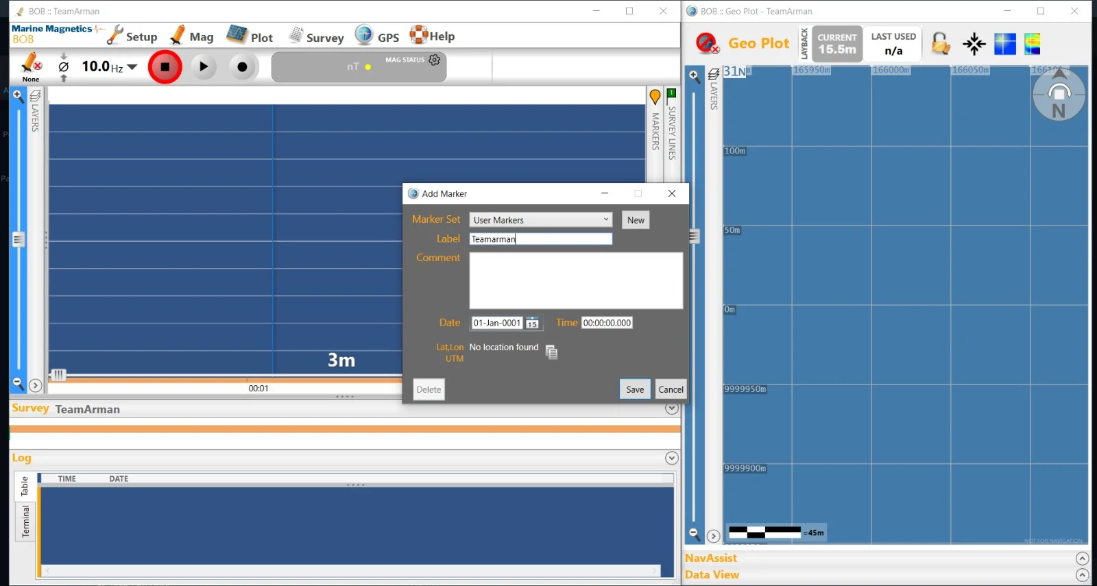
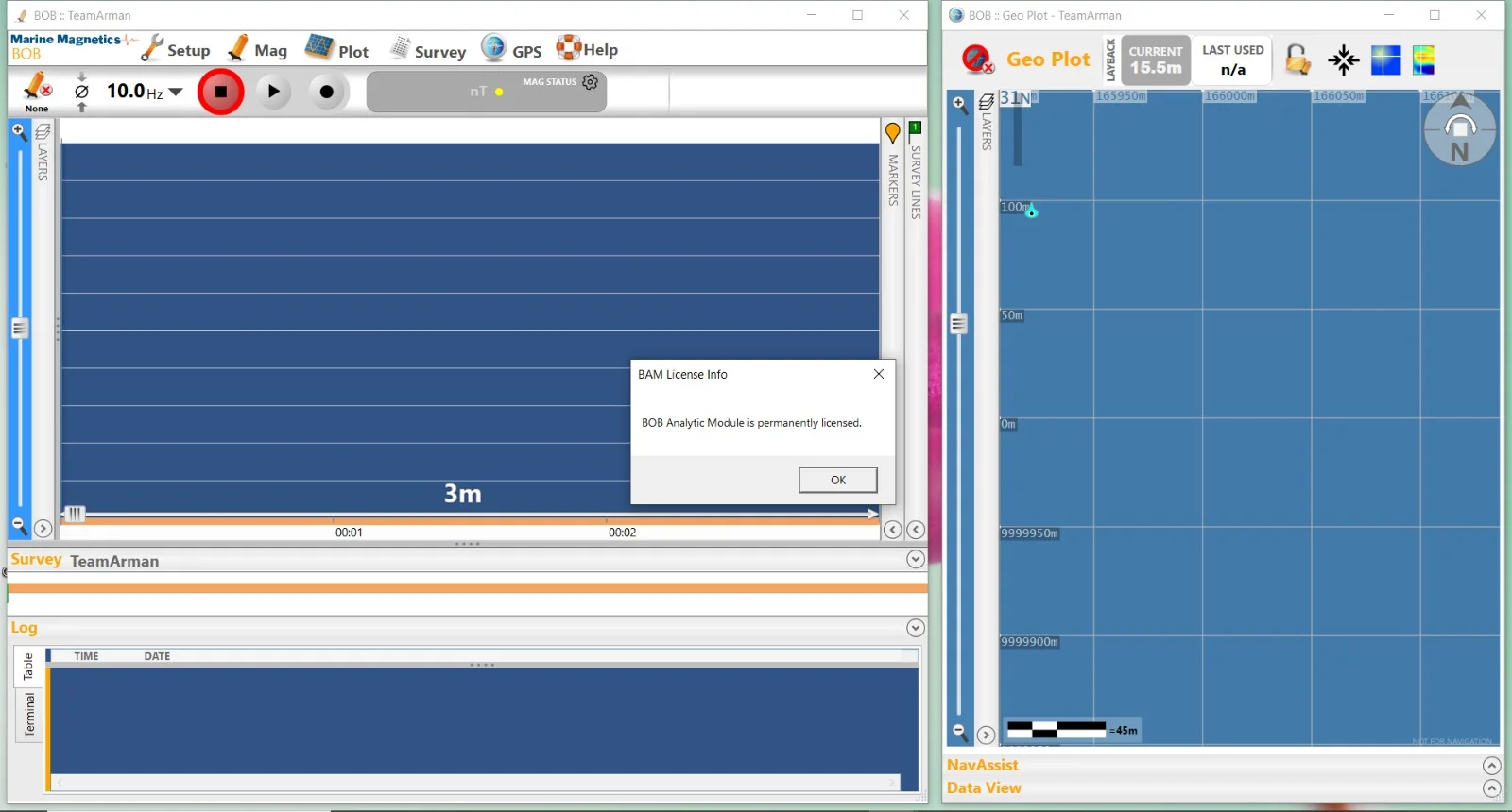
Screenshot
Key Features
-
Real-time magnetic data acquisition from BOB Overhauser magnetometers (0.01 nT sensitivity)
-
Multi-sensor support (single or dual-head BOB configurations)
-
Integrated GPS/GNSS synchronization with NMEA 0183 and $GPGGA parsing
-
Diurnal variation correction using base-station data or historical observatory files (.mag)
-
Anomaly threshold alerting for real-time target detection during survey runs
-
Automated line labeling based on predefined survey grid geometry
-
Export in industry formats: .Xyz, .CSV, .DXF, and geoTIFF contour maps
-
Playback mode for post-survey quality control (QC)
What’s New in Version 8.5.1.668 (2026)
This latest 2026 update introduces several improvements over previous builds:
| Feature | Improvement |
|---|---|
| GNSS engine | Added RTK correction compatibility |
| Data buffer | Reduced logging gaps during high-frequency sampling (10 Hz) |
| Interface | Dark mode UI for field laptop readability |
| Export module | Direct .KML generation for Google Earth |
| Scripting | Python API support for automated QC routines |
System Requirements
To run Marine Magnetics BOB Survey Software 8.5.1.668 reliably in field conditions, your survey laptop or marine computer must meet these specifications:
Minimum Requirements
-
OS: Windows 10 Pro (64-bit) or Windows 11
-
Processor: Intel Core i5 (8th gen) or AMD equivalent
-
RAM: 8 GB
-
Storage: 256 GB SSD (with 10 GB free for survey data)
-
Ports: 1x RS-232 serial or USB-to-serial adapter; 1x USB for hardware key
-
Display: 1366×768 resolution
Recommended Requirements
-
OS: Windows 11 Pro or IoT Enterprise LTSC
-
Processor: Intel Core i7 (12th gen) or AMD Ryzen 7
-
RAM: 16 GB
-
Storage: 512 GB NVMe SSD
-
Display: 1920×1080 (anti-glare, outdoor-readable)
-
GPS: External GNSS receiver with RTK capability
Note: This software is not compatible with Windows 7, 8, macOS (any version), or Linux distributions.
Installation Guide (Legal & Licensed)
Follow these steps to install your licensed copy of Marine Magnetics BOB Survey Software:
-
Obtain a valid license – Purchase directly from Marine Magnetics or an authorized marine geophysical distributor. The software arrives with a USB hardware dongle or activation code.
-
Download the installer – Log into your Marine Magnetics customer portal to get
BOB_Survey_8.5.1.668_Setup.exe. -
Disable antivirus temporarily (optional) – Some security suites may flag COM port communication; add an exception for the BOB software folder.
-
Run the installer as administrator – Right-click the
.exeand select Run as administrator. -
Follow the wizard prompts – Accept the EULA, choose the installation path (default:
C:\Program Files\Marine Magnetics\BOB Survey). -
Insert the hardware key – Connect the USB license dongle before launching for the first time.
-
Activate – If using a software license, enter your 24-character product key in the activation dialog.
How to Use the Software (Field Workflow)
Step 1: Configure Your Hardware
-
Connect the BOB Overhauser magnetometer to the PC via serial port (COM3–COM8 typical).
-
Attach your GNSS receiver (NMEA sentences over USB or Bluetooth).
-
Insert the Marine Magnetics USB license key.
Step 2: Create a New Survey Project
-
Go to
File > New Project -
Define survey name, location (UTM or Lat/Long), and line spacing (e.g., 5 m for UXO detection).
Step 3: Set Acquisition Parameters
-
Sampling rate: 1 Hz (standard) to 10 Hz (high-res)
-
Diurnal correction source: Manual file or live base station
Step 4: Start Logging
-
Click
Start Survey– the software will display raw total-field magnetic data (nT) alongside a real-time anomaly profile. -
Monitor the Anomaly Alert panel (visual and audio cues when magnetic gradient exceeds threshold, e.g., >3 nT/m).
Step 5: Post-Processing
-
Stop logging.
-
Use
Tools > Diurnal Correctionto apply base-station adjustments. -
Export final data via
File > Export > GeoTIFF/CSV.
Best Use Cases
| Industry | Application |
|---|---|
| Offshore renewables | Cable route surveys (wind farms) |
| UXO clearance | Detecting unexploded ordnance in harbors or former military zones |
| Marine archaeology | Locating shipwrecks and submerged iron-age artifacts |
| Oil & gas | Pipeline integrity inspections for magnetic anomalies |
| Academic research | Crustal magnetism studies (coastal regions) |
Advantages and Limitations
Advantages
-
High 0.01 nT resolution for subtle anomaly detection
-
Low power consumption – runs for 8+ hours on a field laptop
-
Intuitive geophysical workflow (no scripting required for basic surveys)
-
Direct integration with industry-standard magnetometers
Limitations
-
Windows-only (no native macOS or Linux support)
-
Hardware license dongle required (can be lost or damaged in field)
-
No native cloud storage integration (manual file backups needed)
-
Steep learning curve for users without geophysics background
Alternatives to Marine Magnetics BOB Software
| Software | Platform | Best for | Key difference |
|---|---|---|---|
| Geometrics MagLog | Windows | UXO surveys | More UXO-specific templates |
| SeaSPY2 Logger | Windows | Deep-tow magnetometry | Extended towing (up to 600 m) |
| Qinsy | Windows | Multibeam + magnetics | All-in-one hydrographic suite |
| SonarWiz Map | Windows | Side-scan with magnetics | Stronger side-scan fusion |
| OpenCPN with magnetic plugin | Cross-platform | Budget/low-cost surveys | Open-source, less support |
Frequently Asked Questions (FAQ)
1. Is Marine Magnetics BOB Survey Software 8.5.1.668 compatible with Windows 11?
Yes. Full compatibility with Windows 11 Pro (64-bit). Ensure your USB serial drivers are up to date.
2. Can I use this software without a physical magnetometer?
No. The software is designed exclusively for Marine Magnetics BOB hardware. It will not generate simulated data.
3. How do I perform a diurnal correction in version 8.5.1.668?
Go to Tools > Diurnal Correction. Load a base-station .MAG file (available from INTERMAGNET or your local observatory). The software applies corrections automatically.
4. What file formats can I export survey data to?
You can export cleaned magnetic data as .CSV, .XYZ, .DXF, geoTIFF maps, and .KML for Google Earth.
5. Does the software support RTK GPS input?
Yes, as of version 8.5.1.668. Use the GPS > RTK Settings tab to configure NMEA GGA messages at 5–20 Hz.
6. Is there a free trial available?
Marine Magnetics offers a 14-day demo license (no data export). Request it through their official website. No cracked or torrent versions exist legally.
7. How often does Marine Magnetics release updates?
Major updates (~1–2 per year). Version 8.5.x is the 2025–2026 stable branch. Security patches are distributed via the customer portal.
8. Can I run two BOB sensors simultaneously?
Yes. The software supports dual-head magnetometer arrays for gradient surveys (vertical or horizontal configurations).
Final Thoughts
Marine Magnetics BOB Survey Software 8.5.1.668 (2026) remains a benchmark application for professional marine magnetic surveys. Its combination of real-time anomaly detection, robust diurnal correction, and multi-sensor support makes it indispensable for UXO clearance, pipeline inspection, and offshore wind farm development.
While the Windows-only restriction and hardware key requirement may be limiting for some users, the software’s reliability in harsh marine environments—and its adherence to geophysical best practices—justifies its place in any professional surveyor’s toolkit.
For legal, licensed use, always purchase directly from Marine Magnetics Corp. Avoid unauthorized download sites; they often contain malware or non-functional files. As marine surveys become more regulated (SOLAS, IHO standards), using validated, up-to-date software is not just recommended—it is legally required for commercial projects.
Our Paid Service
“We do not sell or provide any software. We only offer professional support services. If any software on your system is not working properly, or you are facing installation errors, crashes, or any other technical issue — just contact us. We will help you fix the problem quickly and remotely via AnyDesk. No software will be provided from our side — only expert troubleshooting and support.”