

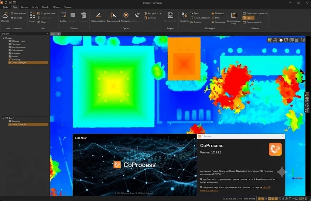
Overview of CoProcess 2026.1.0
Table of Contents
CHC Navigation (CHCNAV) CoProcess 2026.1.0 is a professional GNSS data processing software designed for surveyors, geospatial professionals, and engineering teams. This powerful post-processing kinematic (PPK) software enables users to process raw GNSS observations with exceptional precision, delivering centimeter-level accuracy for diverse surveying applications.
CHCNAV developed CoProcess to streamline GPS data processing workflows and enhance productivity for land surveying, construction, and geodetic surveying projects. The 2026.1.0 version introduces significant performance improvements and updated GNSS constellation support, making it a vital tool for modern surveying operations.
As a comprehensive surveying software solution, CoProcess supports multiple GNSS systems including GPS, GLONASS, BeiDou, and Galileo. The software processes static, kinematic, and PPK data with advanced algorithms that deliver reliable positioning results. CHCNAV CoProcess has earned recognition among surveying professionals for its intuitive interface and robust processing capabilities.
Key Features
Advanced GNSS Data Processing
CoProcess delivers sophisticated GNSS data processing capabilities for various survey methodologies:
-
Static Processing: Handles long-duration observations for high-accuracy control networks
-
Kinematic Processing: Supports mobile data collection with real-time positioning
-
Post-Processing Kinematic (PPK): Enables centimeter-level accuracy by processing base and rover data
-
Real-Time Kinematic (RTK): Provides live positioning corrections for immediate field use
Multi-Constellation Support
The 2026.1.0 version expands support for all major GNSS constellations:
-
GPS (L1, L2, L5 frequencies)
-
GLONASS (L1, L2)
-
BeiDou (B1, B2, B3)
-
Galileo (E1, E5a, E5b, E6)
-
QZSS and SBAS augmentation systems
User-Friendly Interface
CHCNAV CoProcess features an intuitive interface that simplifies complex data processing workflows:
-
Project-based organization for efficient data management
-
Visual data plotting for quality assessment
-
One-click processing options for common tasks
-
Customizable reporting templates
Advanced Data Quality Control
Ensure measurement reliability with comprehensive quality assessment tools:
-
Satellite visibility and DOP (Dilution of Precision) analysis
-
Cycle slip detection and repair
-
Multipath effect mitigation
-
Standard deviation and RMS error reporting
Data Import and Export Flexibility
CoProcess 2026.1.0 supports numerous file formats for seamless integration with existing workflows:
-
RINEX format (2.x, 3.x, 4.x)
-
CHCNAV raw data formats
-
Various GNSS receiver proprietary formats
-
GIS and CAD compatible exports (DXF, Shapefile, CSV)
-
Google Earth KML/KMZ output
What’s New in Version 2026.1.0
Enhanced Processing Algorithms
The latest CoProcess version features refined processing algorithms that improve accuracy and processing speed. New filtering techniques reduce noise while maintaining precision, resulting in cleaner positioning results.
Updated GNSS Constellation Support
CoProcess 2026.1.0 includes the latest ephemeris data for all GNSS constellations. This ensures compatibility with the newest satellites and improved positioning availability, especially in challenging environments.
Performance Optimizations
Processing large datasets is now faster with optimized memory management and multi-threading capabilities. Users working with extensive survey projects will notice significant processing time reductions.
Improved Report Generation
The reporting module now offers enhanced customization options and clearer presentation of processing results. Export professional-quality reports with minimal effort.
User Experience Enhancements
Interface refinements based on user feedback make navigation more intuitive. Context-sensitive help and improved tooltips assist both new and experienced users.
System Requirements
Minimum Specifications
| Component | Requirement |
|---|---|
| Operating System | Windows 10/11 (64-bit) |
| Processor | Intel Core i5 or equivalent |
| RAM | 8 GB |
| Storage | 10 GB available space |
| Display | 1920 x 1080 resolution |
| Graphics | DirectX 11 compatible |
Recommended Specifications
| Component | Requirement |
|---|---|
| Operating System | Windows 11 Pro (64-bit) |
| Processor | Intel Core i7 or AMD Ryzen 7 |
| RAM | 16 GB or higher |
| Storage | 20 GB SSD |
| Display | 4K resolution |
| Graphics | Dedicated GPU with 4 GB VRAM |
Additional Requirements
-
Internet connection for software activation and updates
-
USB port for license key (if using hardware dongle)
-
Compatible GNSS receivers for data collection
Installation Guide
Pre-Installation Preparation
Before installing CHCNAV CoProcess, complete these preparation steps:
-
Check System Compatibility: Verify your computer meets the minimum system requirements
-
Disable Antivirus Temporarily: Some security software may interfere with installation
-
Close Background Applications: Free system resources for smoother installation
-
Back Up Existing Projects: Preserve your current data before upgrading
-
Verify Software License: Ensure you have a valid license key ready
Step-by-Step Installation Process
Step 1: Download the Software
Obtain the CoProcess 2026.1.0 installation package from the official CHCNAV website or authorized distributor portal.
Step 2: Run the Installer
Double-click the downloaded .exe file and grant administrative permissions when prompted.
Step 3: Select Installation Directory
Choose the installation location or accept the default path C:\Program Files\CHCNAV\CoProcess\.
Step 4: Choose Components
Select which software components to install. The typical installation includes all essential features.
Step 5: Complete Installation
Follow the on-screen prompts and wait for the installation to finish. This typically takes 5-10 minutes.
Step 6: Activate the Software
Launch CoProcess and activate your license:
-
Enter the license key provided with your purchase
-
Activate online (requires internet connection)
-
Alternatively, use the hardware dongle if applicable
Post-Installation Configuration
After installation, configure these settings for optimal performance:
-
Set your local coordinate system preferences
-
Configure GNSS processing parameters
-
Import customized templates
-
Connect to your receiver for data synchronization
How to Use CoProcess 2026.1.0
Creating a New Project
-
Launch CHCNAV CoProcess
-
Click “New Project” from the welcome screen
-
Enter project name and specify the project folder location
-
Set coordinate system and projection parameters
-
Configure survey settings (units, datum, etc.)
-
Click “Create” to initialize the project
Importing GNSS Data
CHCNAV CoProcess supports multiple data import methods:
-
Direct Receiver Connection: Connect your CHCNAV receiver and transfer data directly
-
File Import: Import RINEX or raw data files from various GNSS receivers
-
Batch Import: Process multiple data files simultaneously
To import data:
-
Select the “Import” option from the toolbar
-
Choose your file type (RINEX, CHC raw, etc.)
-
Navigate to your data file location
-
Select the file and configure import parameters
-
Click “Import” to load the data
Processing GNSS Data
Baseline Processing
-
Create a baseline between reference station and rover points
-
Set processing parameters (elevation mask, processing mode)
-
Click “Process” to compute the solution
-
Review quality indicators (ratio, RMS, fixed/float solution)
Network Adjustment
-
Build a network with all survey points
-
Define constraints based on known control points
-
Run least-squares adjustment
-
Analyze residuals and adjust constraints as needed
Quality Assessment
Monitor processing quality through:
-
Satellite View: Visualize satellite positions and signal strength
-
Residual Plots: Identify systematic errors
-
Statistical Summary: Review precision metrics
-
Solution Comparison: Compare different processing approaches
Exporting Results
Export processed data in various formats:
-
Select the points or trajectories to export
-
Choose the output format
-
Configure export options
-
Generate the output file
Best Use Cases
Land Surveying and Cadastral Mapping
CHCNAV CoProcess excels in property boundary surveys and land parcel mapping. Surveyors achieve sub-centimeter accuracy for legal boundary determinations, making it a reliable surveying software for cadastral applications.
Construction Site Layout
Construction professionals use PPK data processing for:
-
Machine control and guidance
-
Grade checking and earthwork calculations
-
As-built verification
-
Site control establishment
Infrastructure Monitoring
Monitor structural movement and deformation with:
-
Dam and bridge deflection monitoring
-
Landslide and subsidence detection
-
Tunnel excavation control
-
Pipeline route surveys
Agricultural Mapping
Precision agriculture benefits from:
-
Field boundary determination
-
Drainage and irrigation planning
-
Yield mapping
-
Crop health assessment through elevation data
Photogrammetry and LiDAR Support
Integrate GNSS data with aerial surveys for:
-
Drone mapping ground control
-
Aerial triangulation support
-
LiDAR trajectory processing
-
Orthophoto georeferencing
Advantages and Limitations
Advantages
| Advantage | Description |
|---|---|
| High Accuracy | Achieves centimeter-level precision with proper GNSS data processing |
| Comprehensive Processing | Handles static, kinematic, PPK, and RTK processing modes |
| Multi-Constellation Support | Works with all major GNSS systems for reliable coverage |
| User-Friendly Interface | Intuitive design reduces learning curve |
| Flexible Data Export | Compatible with GIS, CAD, and mapping applications |
| Regular Updates | CHCNAV provides continuous software improvements |
Limitations
| Limitation | Description |
|---|---|
| Windows-Only | Currently only available for Windows operating systems |
| Licensing Cost | Requires a commercial license purchase |
| Learning Curve | Advanced features require training for optimal use |
| Hardware Compatibility | Best performance with CHCNAV brand receivers |
| Processing Speed | Large datasets may require significant processing time |
Alternatives to CHCNAV CoProcess
Trimble Business Center
Trimble’s comprehensive surveying software offers robust GNSS processing with integrated CAD functionality. It supports multiple GNSS receivers and provides extensive reporting options. However, it comes with higher cost and complexity.
Comparison: CoProcess offers similar functionality at a more accessible price point, with simpler interface design.
Leica Infinity
Leica’s processing software excels in integrated workflows, combining GNSS, total station, and level data processing. It features advanced visualization capabilities but requires substantial training for proficiency.
Comparison: CoProcess provides better value for organizations primarily focused on GNSS processing.
Topcon MAGNET Field
Topcon’s solution emphasizes mobile processing and cloud integration. It offers good GNSS processing but more limited capabilities for post-processing workflows.
Comparison: CoProcess delivers superior post-processing features for desktop-based workflows.
Open-Source Alternatives
RTKLIB provides free GNSS processing capabilities with extensive functionality, albeit with limited user support and a steeper learning curve.
Comparison: CoProcess offers commercial-grade reliability and support for professional use.
u-blox u-center
This software focuses primarily on u-blox receiver compatibility, making it less versatile for mixed-receiver environments.
Comparison: CoProcess supports a wider range of GNSS receivers for greater flexibility.
Frequently Asked Questions
What is CHCNAV CoProcess used for?
CHCNAV CoProcess is used for professional GNSS data processing, enabling surveyors and geospatial professionals to achieve centimeter-level accuracy from raw GPS/GNSS observations. The software processes static, kinematic, PPK, and RTK data for various surveying applications.
Is CoProcess compatible with non-CHCNAV receivers?
Yes, CoProcess 2026.1.0 supports standard RINEX data formats, making it compatible with most GNSS receivers from various manufacturers. However, optimal performance is achieved with CHCNAV receivers.
How accurate is CHCNAV CoProcess?
Under ideal conditions, CHCNAV CoProcess achieves sub-centimeter (5-10 mm) accuracy for static processing and centimeter-level accuracy (1-3 cm) for kinematic/PPK processing. Accuracy depends on observation duration, satellite geometry, and environmental conditions.
What file formats does CoProcess support?
CoProcess 2026.1.0 supports RINEX (2.x, 3.x, 4.x), CHCNAV raw data formats, and various proprietary GNSS receiver formats. Export options include DXF, Shapefile, KML/KMZ, CSV, and professional report formats.
Can I use CoProcess with drone data?
Yes, CHCNAV CoProcess effectively processes GNSS data from drone surveys, providing ground control support, PPK trajectory processing, and georeferencing for photogrammetry and LiDAR applications.
Does CoProcess support real-time processing?
CoProcess 2026.1.0 primarily focuses on post-processing workflows. However, it includes RTK processing capabilities and can integrate with real-time data streams for hybrid workflows.
What’s new in version 2026.1.0?
Version 2026.1.0 introduces enhanced processing algorithms, updated GNSS constellation support, performance optimizations, improved report generation, and user experience enhancements based on customer feedback.
How do I activate my CoProcess license?
Activate your license by launching CoProcess and entering your license key in the activation dialog. Online activation requires internet connection. Alternatively, use the hardware dongle provided with your license.
Final Thoughts
CHC Navigation (CHCNAV) CoProcess 2026.1.0 represents a powerful and accessible solution for professional GNSS data processing. The software addresses the fundamental needs of surveyors and geospatial professionals through its robust processing capabilities, intuitive interface, and comprehensive feature set.
The 2026.1.0 version brings meaningful improvements that enhance processing accuracy and workflow efficiency. Support for multiple GNSS constellations ensures reliable positioning in diverse environments, while flexible data import/export options facilitate seamless integration with existing project workflows.
For surveyors, engineers, and mapping professionals seeking reliable post-processing software, CHCNAV CoProcess offers excellent value. The software balances advanced functionality with accessibility, making it suitable for both experienced professionals and those new to GNSS processing.
While alternatives exist, CoProcess stands out for its combination of accuracy, ease of use, and cost-effectiveness. The regular updates and responsive technical support from CHCNAV further reinforce its value proposition for professional surveying operations.