

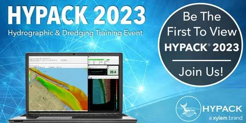
Overview of HYPACK Hydrographic Survey Software
Table of Contents
HYPACK is a world-renowned hydrographic survey software package developed by Coastal Oceanographics, now part of Xylem, a leading water technology company. With over 10,000 users across 140 countries, HYPACK provides surveyors with comprehensive tools for designing surveys, collecting data, processing information, and generating final deliverables. The software supports integration with virtually all major survey equipment manufacturers, including R2Sonic, Kongsberg, Teledyne, Edgetech, and Sonardyne, making it the preferred choice for marine surveying professionals worldwide.
The HYPACK 2023 Q2 v1.23.2 build continues this legacy by introducing significant improvements in data processing, uncertainty management, and survey automation. This version is specifically designed to handle the complete workflow of hydrographic surveying, from navigation and data acquisition to post-processing and final chart production.
The software operates as a modular system, with 12 dedicated modules that support everything from simple surveys to complex large-scale operations. This flexibility allows surveyors to configure the software according to their specific project requirements, optimizing both workflow efficiency and data quality.
Key Features of HYPACK 2023 Q2
Advanced Survey Design and Planning
The survey design module provides comprehensive tools for planning hydrographic surveys. Users can establish survey lines, configure coverage parameters, and optimize data acquisition strategies. The software supports multiple coordinate systems and datum transformations, ensuring compatibility with global navigation standards. The powerful graphics engine allows operators to use existing charts and background maps as reference layers for line planning and real-time data acquisition.
Comprehensive Equipment Integration
One of HYPACK’s greatest strengths is its extensive device support. The software connects seamlessly with:
-
GPS and GNSS systems for precise positioning
-
Single-beam and multibeam echosounders for depth measurement
-
Motion Reference Units (MRU) for vessel motion compensation
-
Side-scan sonar for seafloor imaging
-
Sub-bottom profilers for sediment analysis
-
Tide gauges for water level corrections
-
Sound velocity profilers for acoustic speed compensation
-
Compass and heading sensors for orientation data
Real-Time Data Acquisition and Monitoring
During survey operations, HYPACK provides real-time data acquisition and monitoring capabilities. The HYPACK Survey module displays multiple windows simultaneously, allowing operators to monitor navigation, depth readings, and equipment status in real time. The interface includes keyboard shortcuts like CTRL+T for freezing or unfreezing windows to prevent accidental closures during critical operations.
64-Bit Single Beam Editor (SBMAX64)
The SBMAX64 module represents a significant advancement in single-beam data processing. This 64-bit application handles large datasets efficiently and includes an Auto Digitize button in the Echogram window for automated data detection. This feature accelerates data editing by automatically identifying seafloor returns, reducing manual digitization time.
Advanced Multibeam Processing
The MBMAX64 module supports comprehensive multibeam data processing with advanced filtering capabilities. Users can apply Total Propagated Uncertainty (TPU) standards, including TVU (Total Vertical Uncertainty) and THU (Total Horizontal Uncertainty) filtering options. The software now includes IHO Exclusive Order accuracy standards, allowing surveyors to meet the highest international hydrographic survey specifications.
TPU Editor for Customized Uncertainty Standards
A standout addition in HYPACK 2023 is the TPU Editor, which allows users to customize equipment parameters and uncertainty standards. This feature enables:
-
Custom device configuration for positioning systems, MRU sensors, multibeam systems, and orientation systems
-
User-defined uncertainty standards for depth and position
-
Target identification specifications
-
Up to five custom standards per project
This capability is essential for projects requiring compliance with specific accuracy requirements or for organizations developing proprietary quality control protocols.
What’s New in HYPACK 2023 Q2 v1.23.2
Enhanced Data File Naming
The 2023 Q2 release introduces ISO standard file naming (YYYYMMDD format) for data files, including RAW, HSX, HS2X, and XYZ formats. This improvement simplifies data management and ensures consistent file organization across projects.
New Device Driver Support
HYPACK 2023 adds support for the Dynautics Spectre autonomous vessel control system (spectre.dll), expanding the software’s capabilities for unmanned survey operations. Additionally, the MVP.dll now stores coordinate, date, and time information in SVP (.vel) files, with automatic storage in the project’s SVP directory.
Improved Multibeam Survey Interface
The Hysweep Survey module now displays yellow warning indicators when data packets experience delays exceeding current system time, helping operators identify potential synchronization issues promptly.
Sort Function Enhancement
The Sort module now includes a “Sort with Golden Sounding Priority” option, ensuring that golden soundings are retained regardless of comparison results with other data points. This feature preserves critical depth measurements during automated filtering processes.
TPU Visualization in MBMAX64
The MBMAX64 module now includes TVU, THU, and TPU options in the Selection menu, allowing operators to display uncertainty values in the matrix view. The Search and Filter interface also incorporates TPU filtering options, enabling users to remove data points exceeding TVU or THU thresholds.
System Requirements
Minimum Hardware Requirements
-
Processor: 64-bit compatible processor (Intel Core i5 or equivalent)
-
RAM: 8 GB minimum, 16 GB recommended for large datasets
-
Storage: 10 GB available disk space (SSD recommended)
-
Graphics: Dedicated graphics card with OpenGL 3.3 support
-
Display: 1920 x 1080 resolution or higher
-
Network: Ethernet or Wi-Fi for license verification
Software Requirements
-
Operating System: Windows 10 (64-bit) or Windows 11 (64-bit)
-
Microsoft .NET Framework: Version 4.8 or later
-
Database: SQL Server Express (optional for project management)
Recommended Specifications for Professional Use
-
Processor: Intel Core i7 or AMD Ryzen 7
-
RAM: 32 GB or more
-
Storage: 500 GB SSD + 1 TB HDD for data storage
-
Graphics: NVIDIA Quadro or equivalent workstation GPU
-
Display: Dual monitors for survey and processing workflow
Installation Guide
Pre-Installation Preparation
Before installing HYPACK 2023 Q2 v1.23.2, complete these preparatory steps:
-
Verify system compatibility using the HYPACK System Check utility
-
Disable antivirus software temporarily to prevent installation conflicts
-
Close all running applications to free system resources
-
Backup existing HYPACK projects if upgrading from a previous version
-
Ensure stable internet connection for license activation
Installation Process
-
Download the HYPACK 2023 Q2 installer from the official Xylem website or authorized distributor
-
Run the installer as administrator (right-click > Run as administrator)
-
Select installation directory (default: C:\Program Files\HYPACK)
-
Choose components to install:
-
HYPACK Survey (data acquisition)
-
SBMAX64 (single-beam editing)
-
MBMAX64 (multibeam editing)
-
HYSWEEP (multibeam acquisition)
-
Additional modules as needed for your workflow
-
-
Configure database settings if using centralized project management
-
Complete installation and restart the computer
License Activation
HYPACK uses a machine-specific licensing system (“one machine, one code”). To activate:
-
Launch HYPACK 2023 from the desktop shortcut
-
Enter the provided license key when prompted
-
Verify activation status in the Help > About menu
-
Configure device drivers for connected survey equipment
How to Use the Software
Survey Planning
-
Create a new project and define coordinate system parameters
-
Configure datum transformations for your survey area
-
Import background charts and establish survey lines
-
Set device parameters for all connected instruments
Data Collection
-
Connect survey equipment and verify communication status
-
Start the HYPACK Survey module and position vessel
-
Begin data acquisition and monitor real-time readings
-
Use keyboard shortcuts to control display windows
-
Mark important features and notes during survey
Data Processing
-
Import raw data into SBMAX64 or MBMAX64
-
Apply corrections for tide, sound velocity, and motion
-
Use Auto Digitize for automated seafloor detection
-
Filter data using TPU standards and golden sounding priority
-
Export processed data to CAD, GIS, or chart formats
Best Use Cases
Hydrographic and Bathymetric Surveys
HYPACK excels in conducting hydrographic surveys for navigation charting, port development, and coastal zone management. The software’s comprehensive equipment integration and uncertainty management make it ideal for meeting IHO and other international survey standards.
Dredging Operations Monitoring
The software provides real-time dredging monitoring capabilities, allowing operators to track material removal progress and ensure compliance with project specifications. The system integrates with dredge equipment to display cut depths and monitor actual versus planned elevations.
Environmental Monitoring
HYPACK supports environmental monitoring applications including habitat mapping, sediment analysis, and water quality assessment. The software’s side-scan sonar and sub-bottom profiling capabilities enable detailed seafloor characterization.
Offshore and Coastal Engineering
For offshore construction, cable route surveys, and coastal engineering projects, HYPACK provides the necessary tools for accurate positioning, depth measurement, and data visualization.
Advantages and Limitations
Advantages
-
Comprehensive workflow supports all survey phases from planning to reporting
-
Extensive device compatibility with virtually all major manufacturers
-
64-bit processing handles large datasets efficiently
-
Customizable uncertainty standards ensure quality control compliance
-
Active development with regular updates and new features
-
Global user community with extensive support resources
Limitations
-
Cost may be prohibitive for smaller organizations or occasional users
-
Learning curve requires dedicated training for full proficiency
-
Windows-only operating system compatibility
-
Hardware requirements demand capable computers for optimal performance
-
Licensing model requires individual machine activation
Alternatives to HYPACK Software
UnderSee Explorer
UnderSee Explorer is a free alternative that combines GPS and sounder data to generate real-time contour maps. While it offers basic functionality for simple surveys, it lacks the comprehensive features and equipment integration of HYPACK.
Other Commercial Solutions
The hydrographic survey software market includes several other options, including Teledyne PDS, QPS QINSy, and CARIS HIPS and SIPS. Each offers different capabilities and pricing structures, so organizations should evaluate their specific requirements when selecting survey software.
Frequently Asked Questions
What is HYPACK software used for?
HYPACK is a professional hydrographic survey software used for designing surveys, collecting depth data, processing bathymetric information, and generating final charts and reports for marine surveying applications.
Is HYPACK compatible with my survey equipment?
HYPACK supports most major equipment manufacturers including GPS systems, single-beam and multibeam echosounders, motion sensors, side-scan sonar, sub-bottom profilers, tide gauges, and sound velocity profilers.
What is the TPU Editor in HYPACK 2023?
The TPU Editor is a new feature allowing users to customize equipment parameters and total propagated uncertainty standards for specialized survey applications.
How do I activate HYPACK 2023?
HYPACK uses a machine-specific licensing system. You will receive a license key for your specific machine, which must be entered during the activation process.
Does HYPACK support autonomous survey vessels?
Yes, HYPACK 2023 adds driver support for the Dynautics Spectre autonomous vessel control system, expanding its capabilities for unmanned survey operations.
How do I filter data in HYPACK?
Data filtering is accomplished through the Sort module and MBMAX64 interface, where you can apply TPU standards, golden sounding priority, and other filtering criteria.
Final Thoughts
HYPACK 2023 Q2 v1.23.2 represents a significant advancement in hydrographic survey software, delivering powerful new features that enhance survey planning, data acquisition, and processing capabilities. The introduction of the TPU Editor, improved single-beam and multibeam processing, and enhanced uncertainty visualization demonstrates HYPACK’s commitment to meeting the evolving needs of hydrographic survey professionals.
The software’s comprehensive equipment support, modular design, and 64-bit architecture make it suitable for organizations of all sizes, from small survey operations to large-scale engineering firms. While the investment in HYPACK requires consideration of costs and training requirements, the software’s capabilities and reliability justify its position as the industry standard for hydrographic survey applications.
For surveyors seeking professional-grade hydrographic survey software with comprehensive features and proven reliability, HYPACK 2023 Q2 v1.23.2 offers the tools needed to achieve accurate, efficient, and compliant survey results.
Our Paid Service
“We do not sell or provide any software. We only offer professional support services. If any software on your system is not working properly, or you are facing installation errors, crashes, or any other technical issue — just contact us. We will help you fix the problem quickly and remotely via AnyDesk. No software will be provided from our side — only expert troubleshooting and support.”