
Overview of the Software
Table of Contents
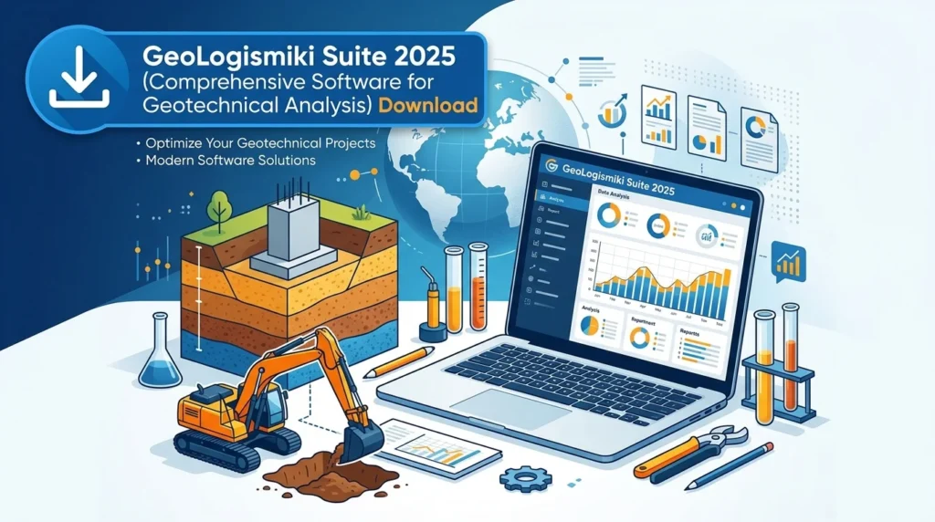
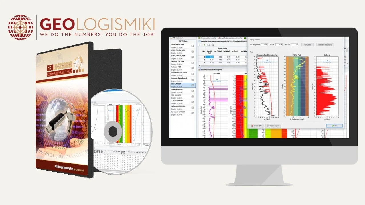
GeoLogismiki Suite 2025 stands as a premier geotechnical analysis software package designed for civil engineers, geologists, and construction professionals who require reliable tools for soil mechanics, foundation design, and slope stability assessment. This comprehensive suite integrates advanced computational methods with user-friendly interfaces, making it an essential resource for both academic research and practical engineering applications.
The software suite includes several specialized modules that address different aspects of geotechnical engineering. From soil property analysis to foundation settlement calculations, GeoLogismiki Suite provides engineers with the analytical power needed to make informed decisions on complex construction projects. Its reputation for accuracy and reliability has made it a trusted choice among geotechnical professionals worldwide.
Key Features
Advanced Soil Mechanics Analysis
The suite offers sophisticated tools for evaluating soil properties and behavior under various loading conditions. Engineers can analyze consolidation, shear strength, and permeability with precision.
-
Stress-strain modeling for different soil types
-
Consolidation analysis with time-dependent settlement predictions
-
Shear strength evaluation using multiple testing methodologies
-
Permeability calculations for drainage and seepage analysis
Foundation Design Tools
GeoLogismiki Suite 2025 includes comprehensive modules for designing and analyzing various foundation types, ensuring structural safety and optimal performance.
-
Shallow foundation design and bearing capacity analysis
-
Deep foundation evaluation for pile and drilled shaft systems
-
Settlement analysis for different soil conditions
-
Load-bearing capacity calculations for complex soil profiles
Slope Stability Analysis
The suite provides robust tools for evaluating slope stability, crucial for infrastructure projects in varied terrain.
-
Limit equilibrium methods for slope stability assessment
-
Finite element analysis for complex geological conditions
-
Seismic stability evaluation for earthquake-prone regions
-
Reinforcement design for slope stabilization projects
Data Visualization and Reporting
Modern engineering demands clear visual representation of complex data. The suite excels in providing intuitive visualization tools.
-
3D modeling of subsurface conditions
-
Graphical presentation of analysis results
-
Customizable report generation
-
Export capabilities for various file formats
What’s New in the Latest Version
GeoLogismiki Suite 2025 introduces significant enhancements that improve workflow efficiency and analytical capabilities.
Enhanced Computational Engine
The latest version features a completely redesigned computational core that processes complex geotechnical problems up to 40% faster than previous releases. This performance boost enables engineers to handle larger datasets and more sophisticated analyses without sacrificing accuracy.
Updated Material Libraries
The 2025 version includes expanded material databases with updated soil properties and rock mechanics parameters. The new libraries incorporate recent research findings and regional geological data, providing more accurate analysis for international projects.
Improved User Interface
The modernized interface offers a more intuitive workflow with customizable toolbars and streamlined navigation. New users can quickly learn the system, while experienced professionals appreciate the enhanced efficiency.
Cloud Integration
Cloud-based collaboration features allow multiple team members to work on projects simultaneously. The integration enables seamless data sharing and version control across distributed engineering teams.
System Requirements
Minimum Hardware Specifications
| Component | Requirement |
|---|---|
| Processor | Intel Core i5 or equivalent |
| RAM | 8 GB |
| Storage | 500 MB available space |
| Display | 1280×1024 resolution |
| Graphics | DirectX 11 compatible |
Recommended Hardware Specifications
| Component | Requirement |
|---|---|
| Processor | Intel Core i7 or AMD Ryzen 7 |
| RAM | 16 GB or higher |
| Storage | 1 GB available space |
| Display | 1920×1080 resolution |
| Graphics | Dedicated GPU with 2GB+ memory |
Operating System Requirements
-
Windows 10 Professional (64-bit) or newer
-
Windows 11 (64-bit)
-
Compatible with Windows Server environments
Additional Software Requirements
-
Microsoft .NET Framework 4.8 or higher
-
Microsoft Excel 2016 or newer for data export functionality
-
PDF reader for documentation access
-
Internet connection for license activation and cloud features
Installation Guide
Step 1: Verify System Requirements
Before installation, confirm that your system meets the minimum requirements. Run the system check utility included with the installation package to identify any potential compatibility issues.
Step 2: Download the Installation File
Access your licensed copy of GeoLogismiki Suite 2025 from the official distribution channel. Ensure you have the correct version for your operating system.
Step 3: Run the Installer
Execute the installation file and follow the on-screen instructions. The installer will guide you through the setup process, including language selection and destination folder choice.
Step 4: License Activation
After installation, launch the software and activate your license using the provided activation key. Online activation is available for registered users, with offline activation options for restricted environments.
Step 5: Verify Installation
Run the included verification utility to confirm all components are properly installed. Test basic functionality to ensure the software operates correctly on your system.
How to Use the Software
Getting Started with Project Setup
Begin your project by selecting the appropriate project template. The software offers templates for common applications, including foundation design, slope stability assessment, and soil analysis.
-
Launch the software and select “New Project”
-
Choose a template matching your analysis requirements
-
Set project parameters including units, location, and project specifications
-
Save your project with a descriptive name
Data Input Methods
The suite supports multiple data input methods to accommodate various workflow preferences.
Manual Data Entry
Directly input soil properties, geometric parameters, and loading conditions through the intuitive data entry interface. The system validates inputs to prevent common errors.
File Import
Import data from standard formats including:
-
CSV files for tabular data
-
DXF files for geometric information
-
Excel spreadsheets for material properties
-
Standard geotechnical data exchange formats
Database Integration
Access built-in material databases or connect to external geological databases for comprehensive soil property information.
Running Analyses
Select the appropriate analysis module based on your engineering requirements. The software guides you through parameter setup and processing.
-
Select analysis type from the available modules
-
Configure analysis parameters according to project specifications
-
Review and verify inputs before running calculations
-
Execute analysis and monitor processing progress
-
Interpret results using the visualization tools
Best Use Cases
Infrastructure Development
GeoLogismiki Suite proves invaluable for large-scale infrastructure projects including:
-
Highway and bridge construction requiring thorough foundation analysis
-
Dam and reservoir projects needing comprehensive geological assessment
-
Railway and transit systems with complex ground interaction requirements
-
Urban development in areas with challenging soil conditions
Mining Operations
The software supports geotechnical analysis for mining operations:
-
Open pit slope stability for safe and efficient extraction
-
Underground excavation analysis for tunnel and shaft construction
-
Waste rock dump stability assessment
-
Tailings dam design and safety evaluation
Environmental Engineering
Environmental applications benefit from the software’s analytical capabilities:
-
Landfill design and containment system analysis
-
Contaminated site remediation planning
-
Groundwater flow and contamination transport modeling
-
Geological hazard assessment and mitigation
Academic Research
Universities and research institutions utilize the suite for:
-
Geotechnical research and experimental validation
-
Student education in civil engineering programs
-
Thesis and dissertation research support
-
Methodology development and validation
Advantages and Limitations
Key Advantages
Accuracy and Reliability
GeoLogismiki Suite incorporates validated algorithms and calculation methodologies that have been tested against physical models and field measurements. Engineers can trust the results for critical infrastructure decisions.
Comprehensive Analysis Capabilities
The suite covers the full spectrum of geotechnical analysis, eliminating the need for multiple specialized tools. This integration improves workflow efficiency and reduces the risk of errors from data transfer between programs.
User-Friendly Interface
Despite its analytical sophistication, the software maintains an intuitive interface accessible to both experienced professionals and less experienced users. Help resources and documentation support rapid learning.
Regular Updates
The development team provides regular updates incorporating the latest research findings and user feedback. This commitment to continuous improvement ensures the software remains current with industry requirements.
Limitations and Considerations
Learning Curve for Advanced Features
While basic functionality is straightforward, the more sophisticated analytical tools require training and experience for effective use. Professionals should allocate time for thorough familiarization.
Specialized Hardware Requirements
The computational aspects of the software, particularly 3D finite element analysis, demand significant processing power and memory. Users should ensure adequate hardware for complex projects.
Cost Considerations
As a comprehensive professional suite, GeoLogismiki Suite represents a significant investment. Organizations should evaluate the return on investment based on their specific project portfolio.
Platform Limitations
The software is primarily Windows-based, with limited support for other operating systems. Organizations using Mac or Linux platforms may need virtualization solutions.
Alternatives to GeoLogismiki Suite
Plaxis 2025
Plaxis is a widely recognized geotechnical analysis software with extensive finite element capabilities. It offers similar functionality but with a different workflow approach.
Strengths:
-
Excellent for complex 3D finite element analysis
-
Strong international user base
-
Comprehensive material models
Considerations:
-
Generally higher cost structure
-
Different interface approach requiring adjustment
RS2 (Phase2) by Rocscience
RS2 provides robust geotechnical analysis with an emphasis on practical engineering applications and ease of use.
Strengths:
-
User-friendly interface for rapid analysis
-
Competitive pricing structure
-
Active user community and support
Considerations:
-
May offer fewer analysis modules than the full GeoLogismiki Suite
-
Some advanced features require additional modules
GEO5
GEO5 delivers comprehensive geotechnical analysis with a focus on European standards and applications.
Strengths:
-
Strong compliance with European design codes
-
Modular approach allows customized packages
-
Good value for specific applications
Considerations:
-
Less extensive North American material database
-
Different interface philosophy
Midland Valley MOVE
MOVE is a specialized solution for geological modeling with strong visualization capabilities.
Strengths:
-
Excellent for visualizing complex geological structures
-
Good integration with GIS data
-
Effective for geological interpretation
Considerations:
-
Less focused on engineering-specific analysis
-
May require supplementary tools for complete design
Open Source Options
Several open-source alternatives provide basic geotechnical analysis capabilities.
Strengths:
-
No licensing fees
-
Community-driven development
-
Transparency in methodology
Considerations:
-
Limited functionality compared to professional suites
-
Technical support typically through community channels
-
May lack validation for professional applications
Frequently Asked Questions
Is GeoLogismiki Suite suitable for small-scale projects?
Yes, the software scales effectively from small residential foundation design to large infrastructure projects. The modular approach allows users to access only the tools needed for their specific project requirements.
What training resources are available?
The software includes comprehensive documentation, video tutorials, and a knowledge base. Professional training programs are also available through the developer and partner organizations.
How does the license work?
Licenses are typically available as perpetual licenses with maintenance agreements or annual subscription options. The license activation process is straightforward and can be managed online or offline.
Can the software import data from other programs?
Yes, GeoLogismiki Suite supports import from common file formats including CSV, DXF, and Excel spreadsheets. Integration with other geotechnical software is also available for specific use cases.
What support options are available?
Technical support includes email assistance, online knowledge base, and priority support for maintenance subscribers. The developer also provides update notifications and technical bulletins.
How often is the software updated?
Updates are typically released quarterly, with major version releases annually. Critical patches are available as needed for urgent issues.
What export formats are supported?
The software supports export to CSV, PDF, DXF, and common image formats. Results can be exported to Excel spreadsheets for further analysis or reporting.
Is there a trial version available?
Yes, the developer offers demonstration versions with limited functionality for evaluation purposes. Contact the sales team for trial access.
Final Thoughts
GeoLogismiki Suite 2025 represents the culmination of decades of development and field experience in geotechnical analysis software. For professionals seeking reliable, comprehensive tools for soil mechanics, foundation design, and slope stability assessment, this suite offers compelling capabilities.
The software’s integration of advanced algorithms with intuitive workflow design makes it accessible to new users while providing the depth and flexibility required by experienced geotechnical engineers. The regular update schedule and commitment to incorporating user feedback ensure the software continues to address the evolving needs of the engineering community.
While the investment may be significant, organizations using the software for critical infrastructure projects typically find the return on investment justified through improved design accuracy, reduced project risk, and enhanced professional credibility. The cloud integration features in the latest version also position the suite as a forward-thinking choice for collaborative engineering projects.