


Overview of the Software
Table of Contents
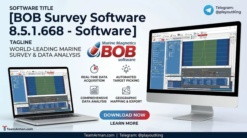
Marine Magnetics BOB Survey Software 8.5.1.668 is a professional-grade geophysical data acquisition and processing platform built specifically for marine magnetometer surveys. Released in 2026, this version continues the BOB (Boat-towed Overhauser Bundle) lineage, serving geophysicists, hydrographers, and survey contractors who collect high-sensitivity total-field magnetic data for subsea UXO detection, pipeline route surveys, archaeological mapping, and offshore energy projects. The software is developed by Marine Magnetics Corp., a Canadian company known for high-sensitivity marine magnetometers and gradiometers. BOB runs natively on Windows 64-bit systems and is designed for field deployment aboard survey vessels, offering real-time magnetic anomaly visualization, diurnal correction integration, and seamless export to GIS platforms. It is a legally licensed tool that requires a valid hardware key or subscription from Marine Magnetics—no third-party activators or unauthorized modifications are supported.
Key Features
BOB Survey Software integrates survey planning, live data acquisition, and post-survey quality control into a single Windows application. Below are its core capabilities:
| Feature Category | Capability |
|---|---|
| Data Acquisition | Real-time magnetic data acquisition from BOB Overhauser magnetometers (0.01 nT sensitivity) |
| Sensor Support | Single or dual-head BOB configurations; compatibility with all Marine Magnetics sensors and GEM Systems DRONEMAG™ |
| GNSS Integration | GPS/GNSS synchronization with NMEA 0183 and $GPGGA parsing; 10 Hz GNSS support with automatic interpolation |
| Diurnal Correction | Integration of base-station data or historical observatory files (.mag) |
| Survey Planning | Guide Grid tool and NavAssist for precise line planning and vessel piloting |
| Real-Time Alerting | Anomaly threshold alerting for live target detection during survey runs |
| Data Export | .Xyz, .CSV, .DXF, .KML, and geoTIFF contour maps |
| Playback & QC | Playback mode for post-survey quality control |
| Database | MS SQL database technology for survey storage, annotation, and archiving |
Additional technical strengths include live layback correction that calculates magnetometer position in real time even during vessel turns, and an interactive Survey Overview that allows instant access to any part of a completed or in-progress survey. The Geographic Plot displays both vessel and towfish paths in latitude/longitude or UTM projection with WGS84 datum, with support for georeferenced GeoTIFF background charts.
What’s New in Version 8.5.1.668
The 8.5.1.668 build represents a meaningful refinement over previous 8.5.1 releases. The following improvements were introduced in this version:
-
GNSS engine: Added RTK correction compatibility for centimeter-level positioning accuracy.
-
Data buffer: Reduced logging gaps during high-frequency sampling at 10 Hz.
-
Interface: Dark mode UI for improved readability on field laptops in bright marine environments.
-
Export module: Direct .KML generation for Google Earth visualization.
-
Scripting: Python API support for automated QC routines, enabling users to build custom validation scripts.
These changes follow earlier incremental updates in the 8.5.1 series, including relaxed parsing rules for SeaSPY and Explorer readings (v 8.5.1.659), direct Synapse RS232 connection without a transceiver (v 8.5.1.656), and Gen 3 transceiver support with auto-detection (v 8.5.1.645).
System Requirements
To run BOB Survey Software 8.5.1.668 reliably in field conditions, a Windows-based survey laptop or marine computer must meet the following specifications.
Minimum Requirements
-
OS: Windows 10 Pro (64-bit) or Windows 11
-
Processor: Intel Core i5 (8th generation) or AMD equivalent
-
RAM: 8 GB
-
Storage: 256 GB SSD with at least 10 GB free for survey data
-
Ports: 1x RS-232 serial or USB-to-serial adapter; 1x USB for hardware key
-
Display: 1366×768 resolution
Recommended Requirements
-
OS: Windows 11 Pro or IoT Enterprise LTSC
-
Processor: Intel Core i7 (12th generation) or AMD Ryzen 7
-
RAM: 16 GB
-
Storage: 512 GB NVMe SSD
-
Display: 1920×1080 anti-glare, outdoor-readable
-
GPS: External GNSS receiver with RTK capability
Compatibility note: BOB Survey Software is not compatible with Windows 7, Windows 8, macOS, or Linux distributions. For transceivers manufactured before mid-2024, Virtual COM Port (VCP) drivers may be required to access RS-232 ports via USB.
Installation Guide (Legal & Licensed)
Installing BOB Survey Software requires a valid license obtained directly from Marine Magnetics or an authorized marine geophysical distributor. The software ships with a USB hardware dongle or activation code. Follow these steps:
-
Obtain a valid license — Purchase from Marine Magnetics or an authorized reseller. The license includes either a USB hardware dongle or a software activation code.
-
Download the installer — Log into your Marine Magnetics customer portal to retrieve
BOB_Survey_8.5.1.668_Setup.exe. -
Disable antivirus temporarily (optional) — Some security suites may flag COM port communication; add an exception for the BOB software folder if installation or initial connection fails.
-
Run the installer as administrator — Right-click the
.exeand select Run as administrator. -
Follow the wizard prompts — Accept the EULA, choose the installation path (default:
C:\Program Files\Marine Magnetics\BOB Survey), and complete the setup. -
Connect hardware — Attach the magnetometer and GNSS receiver via COM or USB ports. BOB’s Setup Assistant guides connection configuration.
For offline installation, Marine Magnetics provides BOBOfflineSetup.exe, which can be copied to a computer without an internet connection.
How to Use the Software: Field Workflow
BOB Survey Software follows a logical three-phase workflow: plan, acquire, and review.
Phase 1: Specify Survey Parameters
Define the survey area and guide lines by setting the Grid location, number of survey lines, line spacing, cross/tie lines, and line bearing. The software generates a grid of green Guide Lines that NavAssist uses to guide the boat operator during the survey. Guide Grids can be saved and imported for future survey planning.
Phase 2: Connect Sensors and Acquire Data
Use the Setup Assistant to connect the GNSS receiver and magnetometer. Sensor readings plot in real time as the survey proceeds. Users can scale X and Y axes to identify patterns, shift individual traces for comparison, and move the cursor in the plot to highlight readings in the Log Table below. The Terminal Tab allows direct raw communication with the magnetometer for advanced diagnostics.
Phase 3: Review and Export
The Review Pane allows users to inspect data collected earlier while simultaneously monitoring real-time data. The Survey Timeline provides at-a-glance navigation through the entire survey. Data can be exported in multiple formats including .CSV, .Xyz, .DXF, .KML, and geoTIFF contour maps, or queried directly via SQL for integration with post-processing software such as GeoSoft or HyPack.
Best Use Cases
BOB Survey Software is purpose-built for marine geophysical applications where magnetic data quality directly affects operational decisions. Its primary use cases include:
-
Unexploded Ordnance (UXO) Detection: Real-time anomaly threshold alerting allows survey crews to identify potential ferrous targets during acquisition, reducing the need for extensive post-processing before follow-up investigation.
-
Pipeline and Cable Route Surveys: Live layback correction maintains accurate magnetometer positioning during turns, ensuring precise target location along linear infrastructure corridors.
-
Archaeological Mapping: High-sensitivity total-field magnetic data supports detection of buried shipwrecks, submerged structures, and cultural heritage sites.
-
Offshore Energy Site Characterization: Pre-construction surveys for wind farms and oil/gas platforms rely on magnetic data to clear sites of ferrous debris and geological magnetic anomalies.
-
AUV-Based Surveys: The AUV + Explorer survey type allows import and processing of magnetic data from autonomous underwater vehicle deployments.
Advantages and Limitations
Advantages
-
Integrated platform: Combines survey planning, real-time acquisition, and QC review in a single Windows application, eliminating the need to switch between multiple tools.
-
Hardware compatibility: Works with all Marine Magnetics sensors (SeaSPY, SeaQuest, Explorer, Synapse) and GEM Systems DRONEMAG™, providing flexibility for operators with mixed fleets.
-
Field-oriented design: Dark mode, live layback correction, and anomaly alerting are designed for the realities of working aboard a survey vessel.
-
Data portability: MS SQL database architecture packs survey settings, parameters, and collected data together, simplifying backup, transfer, and archival.
-
Python API: Automated QC routines can be scripted, reducing manual review time for large surveys.
Limitations
-
Windows-only: No native macOS or Linux support, which may require dedicated survey laptops for crews using non-Windows platforms.
-
Hardware-tied licensing: The USB dongle requirement means the license is physically attached to a machine or must be transferred between machines, which can complicate multi-vessel operations.
-
Learning curve for advanced features: While the Setup Assistant lowers the barrier to entry, features like Python API scripting and direct SQL queries require technical proficiency.
-
No cloud-native collaboration: The MS SQL database model is local-first; real-time multi-vessel data sharing requires additional infrastructure.
Alternatives to the Software
BOB Survey Software occupies a specialized niche in marine magnetometer data acquisition. Alternatives fall into two categories: general-purpose survey platforms and specialized marine geophysical tools.
| Alternative | Category | Key Difference from BOB |
|---|---|---|
| SurveyCTO | General data collection | Web/tablet-based; not designed for real-time magnetometer acquisition |
| KoBo Toolbox | Open-source data collection | Community-driven; lacks marine-specific sensor integration |
| ODK | Open-source survey platform | Highly extensible but requires custom development for magnetometer workflows |
| CSPro | Public-sector survey tool | Free and closed-source; primarily for demographic and household surveys |
| GeoSoft / HyPack | Post-processing | Complementary rather than substitutive; BOB exports directly to these formats |
For operators already using Marine Magnetics hardware, BOB remains the native and most tightly integrated option. Survey teams using mixed-brand magnetometers may evaluate third-party acquisition software, but integration depth and real-time features typically favor vendor-native tools.
Frequently Asked Questions
Is BOB Survey Software free to download?
BOB is free to download for Marine Magnetics customers, but a valid hardware license is required to run the software. Licenses are obtained through Marine Magnetics or authorized distributors.
Can BOB Survey Software run on macOS or Linux?
No. BOB Survey Software 8.5.1.668 is a Windows-only application compatible with Windows 10 Pro (64-bit) and Windows 11. It does not support macOS or Linux.
What magnetometers are compatible with BOB Survey Software?
BOB supports all Marine Magnetics sensors, including SeaSPY, SeaQuest, Explorer, Synapse, and the AUV Explorer. It also supports GEM Systems DRONEMAG™ sensors.
Does BOB Survey Software require an internet connection?
No. BOB works fully offline. An offline installer (BOBOfflineSetup.exe) is available for computers without network access.
What export formats does BOB Survey Software support?
BOB exports data in .Xyz, .CSV, .DXF, .KML, and geoTIFF contour map formats. SQL query access is also available for direct database integration.
How does BOB handle magnetometer position during vessel turns?
BOB calculates mag layback in real time, combining the fixed layback distance with the vessel’s track curve to pinpoint the magnetometer’s position even during turns.
Is there a Python API in BOB Survey Software?
Yes. Version 8.5.1.668 introduced Python API support for automated QC routines, allowing users to script custom validation and processing workflows.
What is the difference between BOB and BAM?
BOB is the data acquisition and survey planning module. BAM (BOB Analysis Module) is a companion tool that adds analytic signal map generation for enhanced magnetic anomaly interpretation.
Final Thoughts
BOB Survey Software 8.5.1.668 is a mature, field-tested platform for marine magnetometer survey operations. Its 2026 update brings meaningful improvements—RTK GNSS compatibility, dark mode, Python API, and reduced logging gaps—that directly address the practical demands of offshore data acquisition. The software’s tight integration with Marine Magnetics hardware, combined with a workflow that spans planning through QC, makes it a strong choice for survey contractors and research organizations operating in the marine geophysical space. For teams requiring precise, real-time magnetic data in challenging marine environments, BOB 8.5.1.668 represents a reliable and legally licensed solution.
Our Paid Service