
Overview of 3Dsurvey
Table of Contents
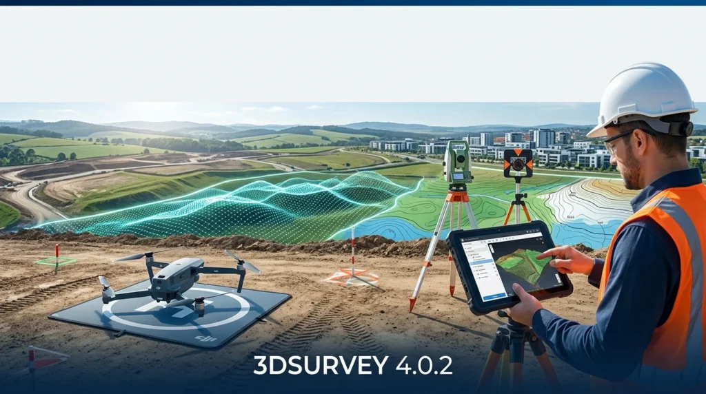
3Dsurvey 4.0.2 is a professional-grade software tailored for land surveyors, civil engineers, and geospatial professionals. Unlike basic mapping tools, it focuses on delivering survey-grade accuracy from UAV and drone data.
Designed to handle complex photogrammetry workflows, this software allows users to generate Digital Elevation Models, orthophotos, and detailed 3D terrain visualizations with precision that meets professional surveying standards. By combining powerful automation with fine-tuned control, 3Dsurvey empowers users to complete mapping projects efficiently and reliably.
Key Features of 3Dsurvey 4.0.2
3Dsurvey 4.0.2 is packed with features that streamline the mapping and surveying process. Here are its core functionalities that make it an industry-relevant tool.
-
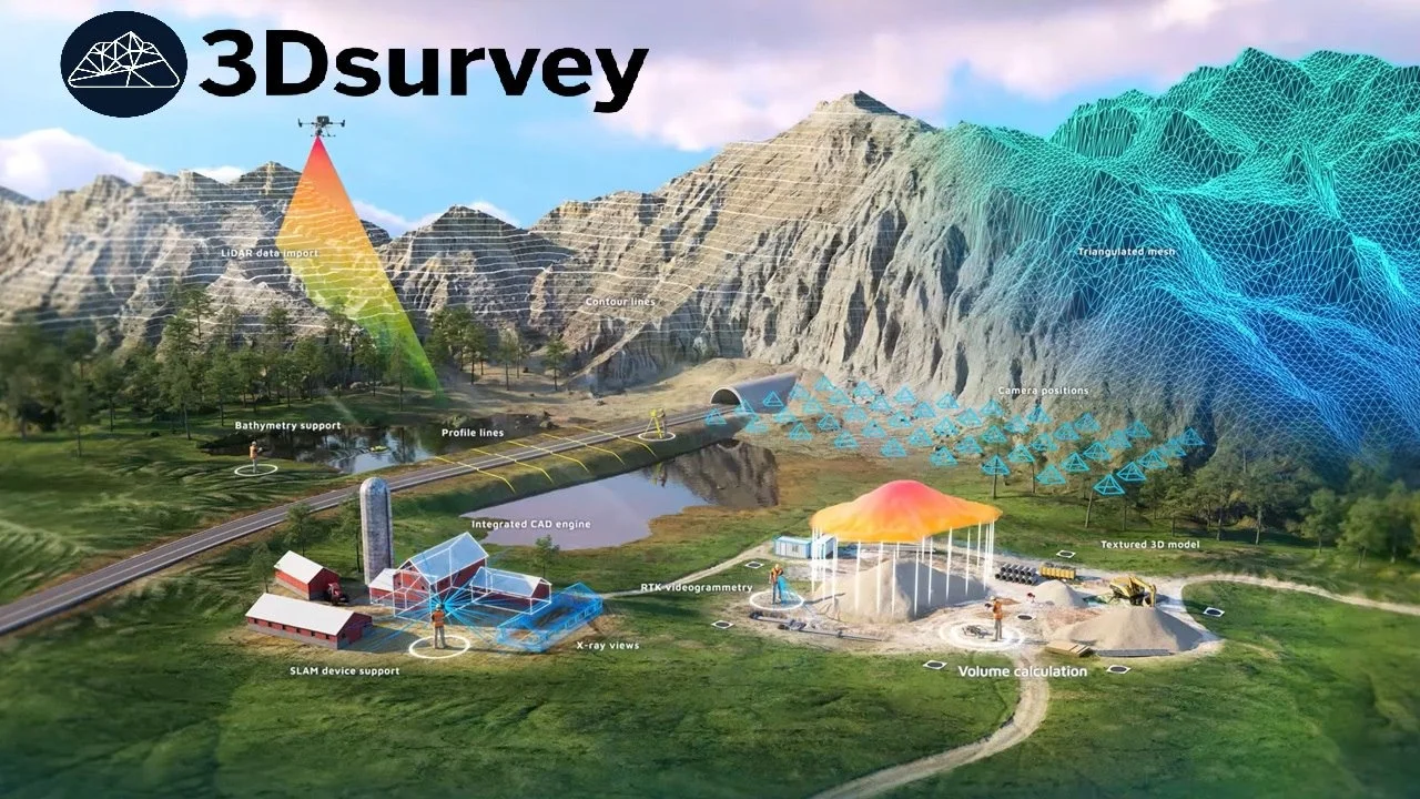
Automated Point Cloud Processing: Rapidly process large datasets from UAV captures using advanced algorithms to convert raw images into dense 3D point clouds with minimal manual intervention.
-
High-Accuracy Vectorization: Utilize built-in tools for precise vector drawing, allowing surveyors to create clear topographic maps and site plans directly from the generated 3D models.
-
GIS and CAD Integration: Seamlessly import and export data in industry-standard formats like DXF, LAS, and GeoTIFF, ensuring 3Dsurvey fits perfectly into existing professional workflows.
-
Volume Calculation and Measurement: Perform accurate volumetric calculations for earthworks, stockpile analysis, and excavation projects directly within the software environment.
-
Terrain Modeling: Generate high-resolution digital surface models (DSMs) and digital terrain models (DTMs) to support detailed topographic analysis.
What’s New in Version 4.0.2
Version 4.0.2 of 3Dsurvey brings essential enhancements focused on performance, usability, and data processing efficiency.
The updated software offers improved point cloud classification algorithms for better separation of ground, vegetation, and man-made structures. Users will notice faster processing speeds, particularly when handling high-density datasets captured during large-scale UAV mapping missions. Additionally, the user interface has been refined for a more intuitive experience, reducing the learning curve for new surveyors.
System Requirements for 3Dsurvey 4.0.2
To run 3Dsurvey 4.0.2 with optimal performance, your system should meet the following recommendations:
-
Operating System: Windows 10 (64-bit) or newer.
-
Processor (CPU): Intel Core i7 or AMD Ryzen 7 with high single-core speed for processing.
-
Memory (RAM): 32 GB is recommended for medium-sized projects, with 64 GB or more suggested for large surveys.
-
Graphics Card (GPU): NVIDIA GeForce or Quadro with 8GB VRAM for accelerated processing.
-
Storage: Fast SSD (Solid State Drive) with at least 100 GB of free space for active projects.
These specifications ensure smooth performance, even when managing dense point clouds and high-resolution orthophotos.
Installation Guide
Installing 3Dsurvey 4.0.2 is a straightforward process. Follow these steps to get started with your professional mapping workflow.
-
Download the Installer: Visit the official 3Dsurvey website and download the latest 4.0.2 version installation package.
-
Run the Setup: Double-click the downloaded executable file to launch the installer. If prompted by User Account Control, confirm to proceed.
-
Accept the License: Carefully read the End-User License Agreement and accept the terms to continue.
-
Choose the Directory: Select the folder where you want the software installed. The default path is usually sufficient.
-
Complete the Setup: Follow the on-screen prompts and click “Finish” to complete the installation. Ensure your system has the necessary updates for optimal performance.
How to Use 3Dsurvey for Professional Mapping
Mastering 3Dsurvey 4.0.2 involves understanding its core workflow, which is centered around converting imagery into accurate geospatial data.
Setting Up a New Project
When you first launch 3Dsurvey, create a new project by defining the coordinate system and units. Import the drone imagery you captured, ensuring the images have the correct geo-tagging. The software will automatically set up the photogrammetry processing pipeline based on your project parameters.
Processing Point Clouds
This is the most critical step in the 3Dsurvey workflow. By processing the imagery, the software generates a dense 3D point cloud of the surveyed area. This point cloud serves as the foundation for all subsequent outputs, such as orthophotos and digital elevation models. The 4.0.2 version includes refined settings to optimize this process for both speed and accuracy.
Using the Vectorization Tools
Once the point cloud is ready, professionals use 3Dsurvey’s built-in vectorization tools. Within the 3D environment, you can draw lines and shapes over the model to create precise maps of roads, boundaries, and other features. These vector layers are essential for generating final survey-grade deliverables.
Best Use Cases for 3Dsurvey
3Dsurvey 4.0.2 is a versatile tool, but it excels in specific applications. These scenarios demonstrate its capacity to deliver survey-grade accuracy.
-
Topographic Mapping: Quickly and accurately create detailed topographic maps of large areas with minimal ground control points, reducing time spent in the field.
-
Construction Site Monitoring: Track progress and calculate cut-and-fill volumes on construction sites over time, ensuring projects stay on budget and schedule.
-
Mining and Quarry Operations: Conduct inventory measurements of stockpiles and perform volumetric analysis to manage resources effectively.
-
Landscape Architecture: Create precise terrain models for planning and designing sustainable landscape projects.
Advantages and Limitations
Like any advanced software, 3Dsurvey has strengths and considerations.
Advantages:
-
Survey-Grade Accuracy: Delivers geospatial data that meets high precision standards for professional land surveying.
-
Efficient Automation: Speeds up photogrammetry workflows, allowing for faster data processing.
-
Professional Integration: Direct compatibility with common GIS and CAD software via standard file formats.
-
User-Friendly Interface: Designed to be accessible for professionals without a steep learning curve.
Limitations:
-
Processing Power: Large, high-resolution UAV datasets can be resource-intensive and require a powerful workstation for optimal performance.
-
Niche Focus: Its primary strength is in professional surveying and mapping, making it less suitable for simple visualization or artistic modeling.
Alternatives to 3Dsurvey
For users evaluating 3Dsurvey, several comparable software options exist in the photogrammetry and mapping space. These tools offer varying degrees of functionality, cost, and specialization.
-
Pix4Dmapper: A widely-used industry leader offering comprehensive photogrammetry and mapping capabilities for various drone applications.
-
Agisoft Metashape: A robust and powerful solution known for its high accuracy and flexible processing options.
-
DroneDeploy: A cloud-based platform offering a user-friendly approach to drone data processing and project management.
-
ContextCapture: A high-end solution ideal for generating detailed 3D reality meshes for large-scale infrastructure projects.
Frequently Asked Questions
Q: What makes 3Dsurvey 4.0.2 different from other mapping software?
A: Its key differentiator is its focus on delivering true survey-grade accuracy. While many tools are designed for visualization, 3Dsurvey is built for professional land surveyors who require their measurements and data to meet strict precision standards.
Q: Is 3Dsurvey compatible with all drones?
A: Yes, 3Dsurvey supports data from a wide range of UAVs, including those from DJI, senseFly, and other models. It processes standard image formats like JPEG and TIFF, provided they have geotagging data.
Q: Can I use 3Dsurvey for construction volume measurement?
A: Yes, this is one of its primary applications. The software includes specialized tools for calculating and comparing volumes of stockpiles, excavation areas, and earthworks, making it an excellent tool for construction project management.
Q: What are the main geospatial file formats supported by 3Dsurvey?
A: 3Dsurvey supports a wide range of standard formats for seamless data exchange. You can import/export LAS/LAZ for point clouds, DXF/DWG for CAD integration, and GeoTIFF/TIFF for orthophotos and DEMs.
Q: How does 3Dsurvey process large mapping projects?
A: The software uses optimized processing algorithms to handle large datasets. However, for the most efficient performance with extensive area surveys, using a high-performance workstation with sufficient RAM and a powerful GPU is recommended.
Final Thoughts
3Dsurvey 4.0.2 stands out as a specialized and powerful solution for professionals who need survey-grade accuracy from UAV-acquired data. Its combination of automation, precision, and professional integration makes it an invaluable asset in the geospatial toolbox. While it requires a capable workstation to handle its processing demands, the efficiency and accuracy it delivers for land mapping, construction monitoring, and volumetric analysis are exceptional. For land surveyors and engineers looking to elevate their workflow, 3Dsurvey 4.0.2 offers a compelling blend of power and precision.