Overview of StrataBugs v3.0.104
Table of Contents
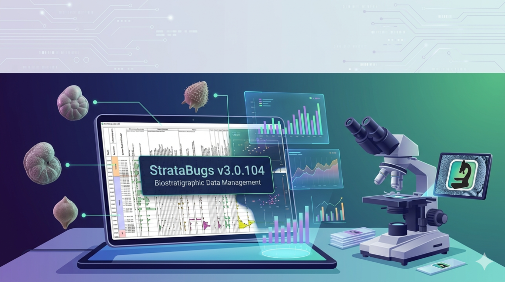
StrataData StrataBugs v3.0.104 is a specialized biostratigraphic data management software designed for petroleum geologists, palynologists, and micropaleontologists. It provides a structured environment to capture, visualize, interpret, and report well-site and exploration stratigraphic data.
Unlike generic database tools, StrataBugs v3.0.104 integrates taxonomic nomenclature, depth-based sample analysis, and zonal scheme management into a single desktop interface. The software is widely used in upstream oil and gas, mining exploration, and academic research where precise fossil occurrence data drives subsurface correlation.
This version (v3.0.104) represents a mature iteration of the software, focusing on workflow stability, enhanced reporting outputs, and compatibility with modern Windows environments.
Key Features of StrataBugs v3.0.104
StrataBugs v3.0.104 offers a comprehensive toolkit for handling complex stratigraphic workflows. Below are the primary features:
-
Taxonomic Database Management – Store and manage species, genera, and higher classifications with age ranges and environmental preferences.
-
Well Correlation Logs – Generate interactive stratigraphic logs showing fossil occurrences, lithology, and sample depths.
-
Zonal Scheme Builder – Define, compare, and apply regional or global biozonation schemes.
-
Data Import/Export Engine – Support for ASCII, Excel (CSV/XLSX), and legacy LAS formats.
-
Range Charts & Abundance Plots – Visualize first and last occurrence (FO/LO) data with abundance scaling.
-
Reporting Module – Automate standardized reports (e.g., Paleontological Summary, Range Table).
-
Quality Control Checks – Validate taxonomic names and depth sorting internally.
NLP entity note: This software falls under the categories of Geological Data Management Systems, Subsurface Analytics, and Paleontological Informatics.
What’s New in StrataBugs v3.0.104
The v3.0.104 release focuses on reliability and usability improvements rather than radical new features. Key updates include:
-
Enhanced Windows 10/11 compatibility (resolved installer issues on 64-bit architectures).
-
Faster query performance when loading large well datasets (>10,000 sample records).
-
Improved graphic export – Vector (EMF) and high-resolution raster (PNG, TIFF) for publication.
-
Bug fix for depth-sorting inconsistencies in multi-well correlation panels.
-
Refined reporting templates now retain user-defined headers.
System Requirements for StrataBugs v3.0.104
Before installing StrataData StrataBugs v3.0.104, ensure your hardware meets these specifications:
| Component | Minimum | Recommended |
|---|---|---|
| Operating System | Windows 10 Pro (64-bit) | Windows 11 Pro or Windows Server 2019 |
| Processor | Intel Core i3 (2.5 GHz) | Intel Core i5 or AMD Ryzen 5 |
| RAM | 4 GB | 8 GB |
| Storage | 500 GB HDD (for database) | 256 GB SSD + 1 TB HDD |
| Display | 1366 x 768 | 1920 x 1080 (dual monitor) |
| Database Engine | Microsoft Access Engine (included) | SQL Server Express (for multi-user) |
Note: The software does not support macOS or Linux natively. Virtualized environments may work but are not officially tested.
Installation Guide for StrataBugs v3.0.104
Follow these steps for a clean installation of StrataBugs v3.0.104. Always use a legitimate licensed copy obtained directly from StrataData or an authorized reseller.
-
Disable antivirus temporarily (to prevent false positives on installer components).
-
Run the setup executable as Administrator (
StrataBugs_v3.0.104_setup.exe). -
Accept the license agreement – This is a standard proprietary software EULA.
-
Choose installation type:
-
Single User (local Access database)
-
Multi-User (requires SQL Server instance)
-
-
Specify data directory – Use a network location for shared projects.
-
Complete installation and restart your workstation.
-
Activate using your license key – The key is provided via email after purchase.
How to Use StrataBugs v3.0.104
This section provides a practical workflow for a typical biostratigraphic project.
Step 1 – Create a New Well Project
-
Launch StrataBugs → File → New Well
-
Enter well name, location, and depth reference (e.g., KB, RT)
Step 2 – Import Sample Data
-
Go to Data → Import Samples
-
Use the CSV template provided in the documentation
-
Required columns:
Sample_ID,Top_Depth,Base_Depth,Formation
Step 3 – Enter Taxonomic Occurrences
-
Open the Taxon Editor
-
Select a sample interval
-
Add species names manually or via batch import
-
Mark First Occurrence (FO) and Last Occurrence (LO) events
Step 4 – Generate a Range Chart
-
Click Visualizations → Range Chart
-
Select target zone (e.g., Globigerinoides trilobus Zone)
-
Export as PNG for report inclusion
Step 5 – Publish a Stratigraphic Summary Report
-
Navigate to Reports → Well Summary
-
Include header: well name, operator, geologist, date
-
Output to PDF or DOCX
Best Use Cases for StrataBugs v3.0.104
StrataBugs v3.0.104 excels in specific industry scenarios:
| Use Case | Description |
|---|---|
| Oil & Gas Exploration | Correlation of offshore wells using planktonic foraminifera zones |
| Mining Biostratigraphy | Age dating of sedimentary-hosted ore bodies (e.g., phosphorites) |
| Academic Research | Digitization of museum paleontological collections |
| Geological Surveys | Standardized reporting for national subsurface databases |
| Well-Site Operations | Real-time sample analysis with offline sync (export to field tablet) |
Advantages and Limitations of StrataBugs v3.0.104
Advantages
-
Industry-standard tool for biostratigraphy (trusted by NOCs and IOCs)
-
Strong taxonomic validation against integrated nomenclatural lists
-
No ongoing cloud subscription – perpetual license available
-
Offline-capable (ideal for remote wells)
Limitations
-
Steep learning curve for non-paleontologists
-
No native cloud or web version (desktop-only)
-
Limited multi-user concurrency without SQL Server setup
-
Minimal machine learning or AI-assisted identification features
Alternatives to StrataData StrataBugs v3.0.104
If StrataBugs does not fit your workflow, consider these alternatives:
| Software | Focus | Platform | Key Difference |
|---|---|---|---|
| PaleoTool | Biostratigraphic charting | Web + Windows | Simpler UI, less taxonomic depth |
| Kingdom Software (IHS Markit) | Full subsurface suite | Windows | Includes seismic, biostratigraphy is secondary |
| Petrel (SLB) | Geomodelling | Windows/Linux | Biostratigraphy via plugin only |
| TSC Stratigraphy | Academic focus | Cross-platform | Open source, limited support |
| Excel + Power BI | Manual workaround | Any | No taxonomic validation or zone logic |
Recommendation: For dedicated biostratigraphic data management, StrataBugs remains the most authoritative option. For integrated petrophysical + stratigraphic workflows, consider Petrel + a StrataBugs export plugin.
Frequently Asked Questions (FAQ)
1. Is StrataData StrataBugs v3.0.104 compatible with Windows 11?
Yes, version 3.0.104 includes fixes for Windows 11 Pro (64-bit). Ensure you install using the “Run as Administrator” option.
2. Can I import data from Excel directly?
Yes. The software accepts XLSX, CSV, and TXT delimited files. A template mapping file is available in the installation folder under /Samples/Import_Templates.
3. Does StrataBugs support multi-user access?
Yes, but only if you configure the SQL Server Express backend. The default Access database is single-user only.
4. How do I update my taxonomic list?
Go to Database → Import Taxonomy. StrataData provides quarterly taxonomic updates for purchase. Alternatively, you can manually edit the reference tables.
5. What is the price of StrataBugs v3.0.104?
Pricing is available upon request from StrataData. As of 2025, a single commercial license starts at approximately $2,500 USD per year (including updates). Academic discounts are offered.
6. Can I export range charts to GeoTIFF or SEG-Y?
No. Export formats are limited to PNG, TIFF, EMF, and PDF. For georeferenced exports, use the coordinates to text option and rebuild in GIS software.
7. Is there a free trial available?
Yes. StrataData offers a 30-day fully functional trial (no data limit) upon request via their official website. No credit card is required for academic verification.
8. Does StrataBugs include age-depth modeling?
Version 3.0.104 does not include automatic age-depth modeling (e.g., linear interpolation between datums). That feature is planned for a future major release (v4.0).
Final Thoughts
StrataData StrataBugs v3.0.104 remains the reference software for biostratigraphic data management in professional geoscience. Its strengths lie in taxonomic rigor, well correlation workflows, and offline reliability. While the interface reflects legacy Windows design patterns, the underlying database logic is mature and trusted by major exploration companies globally.
For teams requiring auditable, repeatable, and publication-ready stratigraphic interpretations, StrataBugs v3.0.104 delivers. New users should budget 2–4 weeks for training. The software is best paired with a dedicated paleontologist or trained data manager.
Our Paid Service
“We do not sell or provide any software. We only offer professional support services. If any software on your system is not working properly, or you are facing installation errors, crashes, or any other technical issue — just contact us. We will help you fix the problem quickly and remotely via AnyDesk. No software will be provided from our side — only expert troubleshooting and support.”