
Overview of the Software
Table of Contents
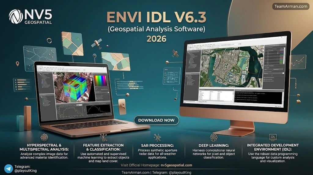
NV5 Geospatial (formerly Harris Geospatial Solutions) develops ENVI and IDL as complementary tools for the Earth science and geospatial community. ENVI — short for Environment for Visualizing Images — is a dedicated application for processing and analyzing geospatial imagery, with deep support for optical, hyperspectral, SAR, and LiDAR data types. IDL (Interactive Data Language) is a scientific programming language used to extract meaningful visualizations from complex numerical data, particularly in astronomy, medical imaging, and remote sensing.
The two products are tightly integrated: ENVI is written in IDL, and IDL scripts can call the full suite of ENVI and SARscape tools directly. This makes the suite uniquely suited to researchers and professionals who need both point-and-click analysis and reproducible, programmatic workflows. ENVI is widely regarded as the industry standard for image processing and analysis, and IDL has been a fixture in Earth science research environments for decades.
Key Features
ENVI IDL V6.3 delivers a broad toolkit organized around three pillars: spectral analysis, data management, and workflow automation. The table below summarizes the core capabilities that define the platform.
| Feature Category | What It Enables |
|---|---|
| Hyperspectral and multispectral analysis | Spectral library building, material identification, target detection (e.g., Adaptive Coherence Estimator), band math, and supervised classification |
| SAR and LiDAR processing | Amplitude classification, coherence analysis, ship detection, oil-spill classification, and 3D point-cloud estimation via SARscape 6.3 |
| ENVI Catalog | Centralized indexing and retrieval of raster files by name, sensor type, spatial location, or metadata, with table, gallery, and map views |
| Data Manager | Hierarchical tree view, HTML-rendered metadata, thumbnail browsing, dynamic band selection, and file grouping |
| Task Scheduler and ENVI Server | Desktop automation of recurring workflows; background, multi-machine task distribution without requiring GSF |
| IDL 9.3 language features | Arrays up to 64 dimensions, BigFloat arbitrary-precision arithmetic, GLTF/GLB and Cesium 3D Tiles output, and WebSocket client support |
ENVI also maintains strong interoperability with Esri ArcGIS, and its IDL-Python bridge allows scripts to be integrated into broader Python-based data science pipelines.
What’s New in the Latest Version
ENVI 6.3 and IDL 9.3 were released in 2026 and focus on reducing friction in data discovery, expanding automation, and modernizing the developer experience. The most consequential updates include:
-
New data type support: AVIRIS-5 HDF products and Sentinel-5P atmospheric data products are now supported natively.
-
ENVI Catalog: A brand-new way to browse, search, and open rasters across local directories. The base installation includes an internal catalog supporting up to 250 images; a separate ENVI Catalog license unlocks custom catalogs, full-disk scanning, and catalog merging.
-
GSF-free ENVI Server: ENVI Server can now start without a Geospatial Services Framework installation, simplifying deployment for background and parallel processing.
-
Desktop Task Scheduler: Recurring workflows can be scheduled through the operating system, running even when ENVI is closed.
-
Viewshed and Feature Counting enhancements: Terrain visibility analysis and grid-based feature management have been refined for more precise spatial accounting.
-
IDL 9.3 developer upgrades: The IDL Workbench now offers deeper task-interface integration with ENVI, smoother Python-IDL interoperability, and new debugging diagnostics such as the
HEAP_DEBUGprocedure.
A patch released after launch resolves an issue affecting image files larger than 4 GB, so users working with large mosaics or high-resolution datasets should ensure it is applied.
System Requirements
The system requirements below reflect the standard ENVI 6.3 / IDL 9.3 installation. Workstations handling very large datasets or running custom ENVI+IDL applications may benefit from additional memory.
Operating systems
-
Windows 10 and 11 (Intel/AMD 64-bit)
-
macOS 12 and 13 (Intel x86_64 and Apple M-series arm64); an X-Windows manager such as XQuartz is required
-
Linux (Intel/AMD 64-bit, kernel 4.18.0 or higher, glibc 2.28 or higher)
Hardware
| Component | Minimum | Recommended |
|---|---|---|
| RAM | 8 GB | More for large datasets or custom applications |
| Disk space | ~4 GB for installation | Additional space for imagery and catalogs |
| Processing cores | 2 | 4 or more |
Licensing note: ENVI and IDL are licensed by maximum concurrent seats. Student licenses are available at reduced cost, and government/educational pricing differs from commercial pricing.
Installation Guide
The installation process differs slightly by platform, but the overall sequence — install, activate, verify — is consistent. The steps below outline the standard path.
Windows Installation
-
Obtain the installer via web download or DVD. The executable follows the naming pattern
idlxx-win.exe(web) orsetup-idlxx-win.exe(DVD). -
Run the installer with administrator privileges and follow the on-screen prompts.
-
Activate the license through the License Administrator when installation completes.
For multi-seat deployments, an .ini file recorded during a first installation can be used to perform silent installations on additional machines.
Linux and macOS Installation
-
Download the appropriate archive:
idlxx-linux.tar.gz,idlxx-mac-arm64.tar.gz(M-series), oridlxx-mac-x86_64.tar.gz(Intel). -
Unpack the archive using
gunzipandtar -xf. -
Run the shell installer:
./install.shand follow the prompts. -
Activate the license after installation.
On macOS, the .pkg installer is also available for both Intel and Apple Silicon architectures, and XQuartz must be installed for X-Windows support.
Post-Installation Verification
After activation, launch the IDL command line (idl) or the IDL Development Environment (idlde) to confirm the installation. If ENVI was installed alongside IDL, running e=envi() from the IDL prompt should start an ENVI session without syntax errors.
How to Use the Software
ENVI IDL supports two complementary modes of work: a graphical workflow for interactive analysis and a programmatic workflow for repeatable, scalable processing. Most professionals move between the two.
Interactive Analysis in ENVI
-
Load data: Use File > Open, or browse and search through ENVI Catalog to load rasters by sensor type or spatial extent.
-
Inspect metadata: The Data Manager displays hierarchical file structure and HTML-rendered metadata, including a world-map thumbnail for spatially referenced data.
-
Apply processing tools: Access spectral analysis, atmospheric correction, classification, and SAR tools from the ENVI Toolbox. Tools can be chained in the ENVI Modeler for visual workflow construction.
-
Export results: Save outputs as GeoTIFF, ENVI raster format, or vector formats including Esri FileGDB.
Programmatic Analysis with IDL
-
Write a procedure or function: IDL programs begin with
PROand end withEND, followed by the program name. -
Call ENVI tasks: IDL scripts can invoke ENVI and SARscape tasks directly, enabling batch processing of multiple files — a common need in hyperspectral preprocessing.
-
Bridge to Python: The IDL-Python bridge allows named structures to be transferred manually between the two languages, supporting hybrid pipelines that combine IDL’s array performance with Python’s ecosystem.
-
Automate with Task Scheduler: Build a workflow in ENVI Modeler or via API, then schedule it to run on a recurring basis through the operating system scheduler.
A practical first exercise for new users is to open a multispectral image, inspect its band properties through the IDL command line, and then reproduce the same analysis as a short IDL script.
Best Use Cases
ENVI IDL is not a general-purpose GIS; it is a specialist platform optimized for imagery-intensive science and analysis. The following use cases represent where the suite delivers the most distinctive value.
Hyperspectral and Spectral Library Analysis
ENVI’s spectral analysis tools allow users to build spectral libraries from reflectance data and identify materials within hyperspectral scenes. In a documented workflow, IDL was used to create an ENVI spectral library from the Toulouse hyperspectral dataset, after which ENVI was used to match materials across the imagery. Target-detection algorithms such as the Adaptive Coherence Estimator support sub-pixel material identification.
SAR and Radar Processing
SARscape 6.3, matched to ENVI 6.3, adds workflows for amplitude classification, coherence and amplitude classification, ship detection with AIS matching, oil-spill classification, inverse-SAR detection and refocusing, and radar cross-section analysis. These are specialized radar capabilities that general GIS platforms do not offer out of the box.
Environmental and Atmospheric Monitoring
The addition of Sentinel-5P atmospheric data products in ENVI 6.3 supports air-quality and trace-gas analysis directly within the platform. Combined with the NDRE (Normalized Difference Red Edge) index, this makes the release relevant to precision agriculture and vegetation-health monitoring.
Research and Custom Algorithm Development
IDL remains a workhorse for scientists who need to prototype algorithms on numerical arrays. Its use in published research spans feature selection for airborne hyperspectral sensors, spectral feature analysis for material mapping, and custom batch-processing functions for multiple hyperspectral files. The IDL Workbench provides a development environment tailored to this kind of numerical experimentation.
Geospatial Workflow Automation at Scale
Organizations that repeatedly process large image archives can use ENVI Server without GSF to distribute ENVI tasks across multiple machines, while Task Scheduler handles recurring jobs such as catalog scanning and product generation. This shifts heavy computation off the local workstation and into a controlled background pipeline.
Advantages and Limitations
Advantages
-
Spectral depth: ENVI’s hyperspectral and multispectral analysis capabilities are among the most mature in the commercial market, with scientifically validated algorithms.
-
Programmable extensibility: IDL gives users full control over data processing and the ability to build custom modules that plug into ENVI.
-
Strong Earth science pedigree: IDL and ENVI are ubiquitous in Earth science research environments, with a broad knowledge base and extensive documentation.
-
Improved automation in 6.3: The combination of ENVI Catalog, GSF-free ENVI Server, and Task Scheduler materially reduces manual overhead for repetitive work.
-
Interoperability: Good cooperation with ArcGIS and a functional IDL-Python bridge support integration into mixed software environments.
Limitations
-
Cost: ENVI IDL is proprietary and comparatively expensive; concurrent-seat licensing can be a barrier for individuals and small teams.
-
Narrower GIS scope: ENVI is specialized for image processing and is not as focused on thematic map production or general-purpose GIS editing as platforms like ArcGIS or QGIS.
-
Collaboration gaps: Out-of-the-box collaborative features are limited compared with modern cloud-native platforms.
-
Learning curve: IDL syntax and ENVI’s scientific orientation require deliberate training; beginners cannot expect immediate fluency.
Alternatives to the Software
The geospatial software market offers several credible alternatives, each with a different balance of cost, specialization, and ecosystem. The comparison below is organized by the type of user most likely to benefit.
| Alternative | Type | Strengths Relative to ENVI IDL | Trade-offs |
|---|---|---|---|
| Esri ArcGIS Pro | Commercial GIS | Deep spatial-analysis integration, ortho-mapping workflows, broad industry adoption | Subscription cost; less specialized in hyperspectral and SAR processing than ENVI |
| QGIS | Open source | Zero license cost; extensive plugin ecosystem (SCP, SNAP, Orfeo Toolbox) enables professional-grade processing | Interface can be less intuitive; advanced spectral tools depend on plugins |
| Google Earth Engine | Cloud platform | Elastic compute for planetary-scale analysis; no local hardware burden | Requires JavaScript/Python coding; not a desktop replacement for interactive pixel-level work |
| ERDAS Imagine | Commercial remote sensing | Established image-processing toolset with a long industry history | Comparable cost structure; narrower community footprint than ENVI |
A common recommendation is a hybrid deployment: use ENVI for spectral and SAR-heavy analysis, ArcGIS Pro for cartographic production and enterprise GIS integration, and QGIS for zero-cost preprocessing or fieldwork support.
Frequently Asked Questions
What is the difference between ENVI and IDL?
ENVI is the image-processing application with a graphical interface, while IDL is the underlying scientific programming language. ENVI is built in IDL, and IDL scripts can call ENVI tasks programmatically. Most users interact with ENVI; developers and researchers use IDL to extend or automate it.
What is new in ENVI 6.3 compared with previous versions?
The headline additions are ENVI Catalog for raster discovery, GSF-free ENVI Server, desktop Task Scheduler automation, support for AVIRIS-5 and Sentinel-5P data, enhanced Viewshed and Feature Counting tools, and FileGDB vector export.
Can ENVI IDL run on Apple Silicon Macs?
Yes. IDL 9.0 and later provide native arm64 installers for M-series Macs, so Rosetta 2 emulation is not required. An X-Windows manager such as XQuartz is still needed for IDL’s Motif-based interface.
How much does an ENVI IDL license cost?
Pricing is quote-based and varies by license type (single-seat, concurrent, student, government). Public procurement records show concurrent ENVI+IDL licenses in the several-thousand-euro range, while IDL runtime licenses have been listed around $458. Student licenses are available at a fraction of commercial cost.
Does ENVI 6.3 require GSF to run the ENVI Server?
No. Starting with ENVI 6.3, ENVI Server can start without a Geospatial Services Framework installation, which simplifies background and parallel processing deployments.
Can I use Python with ENVI IDL?
Yes. The IDL-Python bridge allows Python and IDL to interoperate, though named structures must be transferred manually. Python equivalents such as dataclasses can be used on the Python side.
Is ENVI IDL suitable for beginners?
It is learnable but not entry-level. The graphical ENVI interface is approachable for image inspection, but IDL programming and advanced spectral workflows require training. Beginners should expect to invest time in documentation and structured exercises.
What should I do if ENVI 6.3 crashes with image files larger than 4 GB?
Apply the official ENVI 6.3 Patch, which specifically resolves an issue affecting image files larger than 4 GB in ENVI 6.3.
Final Thoughts
NV5 Geospatial ENVI IDL V6.3 is a mature, deeply capable platform for geospatial analysis, and the 2026 release addresses several long-standing friction points without diluting its scientific core. ENVI Catalog, GSF-free server deployment, and desktop scheduling make the suite more practical for production workflows, while IDL 9.3 continues to serve researchers who need low-level control over numerical processing.
The platform is not the right fit for every geospatial task. Teams focused primarily on cartography or general GIS editing will find better value in ArcGIS Pro or QGIS. But for organizations whose work depends on spectral analysis, SAR processing, hyperspectral material identification, or custom scientific algorithm development, ENVI IDL remains a benchmark tool — and version 6.3 is its most automation-ready release to date. Prospective users should weigh the licensing cost against the specialized capabilities, and consider a hybrid workflow that leverages ENVI for its strengths while using open-source or enterprise GIS tools for complementary tasks.
Our Paid Service
“We do not sell or provide any software. We only offer professional support services. If any software on your system is not working properly, or you are facing installation errors, crashes, or any other technical issue — just contact us. We will help you fix the problem quickly and remotely via AnyDesk. No software will be provided from our side — only expert troubleshooting and support.”